Cof Cymru: National Historic Assets of Wales · Wales
Entrance Gates and Walls near Lower Lodge at Cefnamwlch
Tudweiliog, Gwynedd, Wales
A Grade II listed building in Cefnamwlch, Pwllheli, Tudweiliog, Gwynedd, designated on 2 March 1998.
The record
- Designation
- Listed building, Grade II
- Broad class
- Domestic
- Date of designation
- 2 March 1998
- Locality
- Cefnamwlch
- Town
- Pwllheli
- Community
- Tudweiliog
- Unitary authority
- Gwynedd
- Country
- Wales
- Coordinates
- 52.89604, -4.62014
- Cadw reference
- 19430
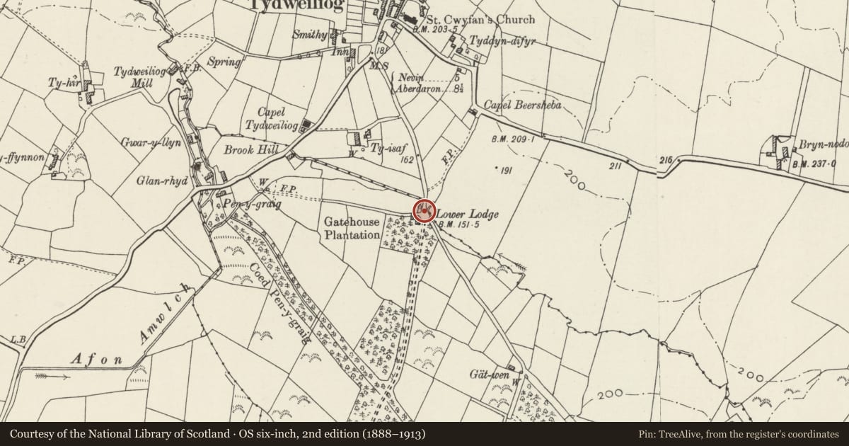
Slide toward Today to fade the historical sheet and see the modern map underneath.
David Rumsey Map Collection, Stanford LibrariesDavid Rumsey Map Collection, Stanford LibrariesDavid Rumsey Map Collection, Stanford LibrariesDavid Rumsey Map Collection, Stanford LibrariesDavid Rumsey Map Collection, Stanford Libraries
5 historical maps cover this location, the earliest the 1608 map "(13) Cambriae Typus." (David Rumsey Map Collection, Stanford Libraries).
Historical maps covering this location
- 1608 · (13) Cambriae Typus. (David Rumsey Map Collection, Stanford Libraries)
- 1830 · V.3:11-15:XV. Britisches Reich. A. Kon: England. b. Frstenthum Wales: Shire: 37-40 (David Rumsey Map Collection, Stanford Libraries)
- 1883 · Watershed map England, Wales 3. (David Rumsey Map Collection, Stanford Libraries)
- 1899 · 134 Pwllheli (Hills) (David Rumsey Map Collection, Stanford Libraries)
- 1901 · Sheet 9 and 10. (David Rumsey Map Collection, Stanford Libraries)
Cadw's description
Location
Situated both sides of the NE end of the main approach drive to Cefnamwlch, off a minor road from Tudweiliog.
History
Entrance gate-piers and wall to Cefn Amwlch, contemporary with the Lower Lodge (q.v.) adjacent, of the 1870s.
Exterior
Entance gate-piers and wall. Three square squat piers with stepped chamfered ashlar caps, flanking driveway and pedestrian gate to right. A fourth at the end of a curved rubble stone wall running NE from driveway. Wall has a band of grey stone and ashlar chamfered coping stones.
Reason for designation
Entrance gateway to the main drive of an important country house and, with the adjacent Lower Lodge, part of the remarkably intact series of estate buildings at Cefnamwlch.
Nearby in the register
- Lower Lodge at CefnamwlchDomesticunder 1 mi
- Church of St CwyfanReligious, Ritual and Funeraryunder 1 mi
- RhentDomesticunder 1 mi
- Summerhouse in walled garden at CefnamwlchDomesticunder 1 mi
Other entries of the same register within about three miles of this one, by straight line.