Cof Cymru: National Historic Assets of Wales · Wales
Pair of Lime Kilns at Ffrith Quarry
Llanfynydd, Flintshire, Wales
A Grade II listed building in Ffrith, Llanfynydd, Flintshire, designated on 23 February 1998.
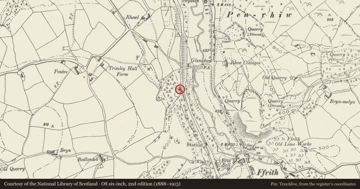
The record
- Designation
- Listed building, Grade II
- Broad class
- Industrial
- Date of designation
- 23 February 1998
- Locality
- Ffrith
- Community
- Llanfynydd
- Unitary authority
- Flintshire
- Country
- Wales
- Coordinates
- 53.09363, -3.07427
- Cadw reference
- 19388
Slide toward Today to fade the historical sheet and see the modern map underneath.
David Rumsey Map Collection, Stanford LibrariesDavid Rumsey Map Collection, Stanford LibrariesLlyfrgell Genedlaethol Cymru – The National Library of WalesDavid Rumsey Map Collection, Stanford LibrariesDavid Rumsey Map Collection, Stanford Libraries
5 historical maps cover this location, the earliest the 1608 map "(13) Cambriae Typus." (David Rumsey Map Collection, Stanford Libraries).
Historical maps covering this location
- 1608 · (13) Cambriae Typus. (David Rumsey Map Collection, Stanford Libraries)
- 1637 · Particular description of Wales. Cambria seu Wallia (David Rumsey Map Collection, Stanford Libraries)
- 1795 · To Sir Watkin Williams-Wynn Bart ... the map of the six counties of North Wales is most… (Llyfrgell Genedlaethol Cymru – The National Library of Wales)
- 1883 · Watershed map England, Wales 3. (David Rumsey Map Collection, Stanford Libraries)
- 1901 · Sheet 9 and 10. (David Rumsey Map Collection, Stanford Libraries)
Cadw's description
Location
Situated c0.75km from Ffrith reached from footpaths leading SW from the B5101.
History
Probably constructed mid or earlier C19; the size and position of the kilns suggests that they were geared to large-scale industrial use.
Exterior
Roughly squared and coursed limestone with brick lining. Pair of large square-plan lime kilns linked by a central buttress with central arched entrance. Each kiln has a central splayed opening with a semicircular head. The kilns are c13m in height and c5m deep.
Reason for designation
Listed as a substantial pair of large well-preserved lime kilns.
Nearby in the register
- Trimley Hall BarnAgriculture and Subsistenceunder 1 mi
- Trimley HallDomesticunder 1 mi
- Ffrith Roman SiteSettlementunder 1 mi
- Pont Newydd y FfrithTransportunder 1 mi
Other entries of the same register within about three miles of this one, by straight line.