Cof Cymru: National Historic Assets of Wales · Wales
Barn and Carthouse opposite Hafod y Maidd including attached pigsties
Cerrigydrudion, Conwy, Wales
A Grade II listed building in Glasfryn, Cerrigydrudion, Conwy, designated on 17 February 1998.
The record
- Designation
- Listed building, Grade II
- Broad class
- Agriculture and Subsistence
- Date of designation
- 17 February 1998
- Locality
- Glasfryn
- Town
- Cerrigydrudion
- Community
- Cerrigydrudion
- Unitary authority
- Conwy
- Country
- Wales
- Coordinates
- 53.04136, -3.61186
- Cadw reference
- 19354
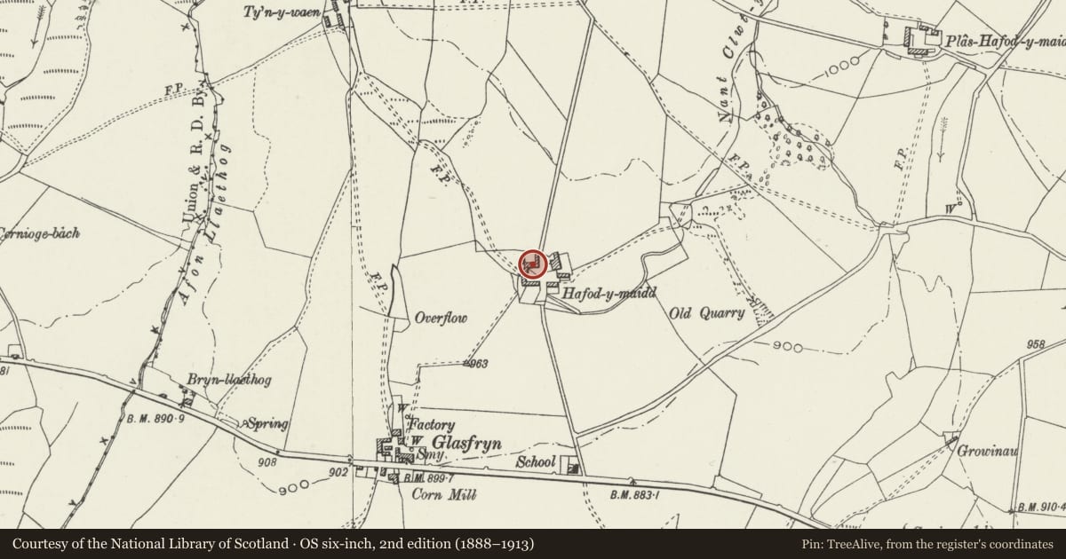
Slide toward Today to fade the historical sheet and see the modern map underneath.
David Rumsey Map Collection, Stanford LibrariesDavid Rumsey Map Collection, Stanford LibrariesLlyfrgell Genedlaethol Cymru – The National Library of WalesDavid Rumsey Map Collection, Stanford LibrariesDavid Rumsey Map Collection, Stanford Libraries
5 historical maps cover this location, the earliest the 1795 map "To Sir Watkin Williams-Wynn Bart ... the map of the six counties of North Wales is most humbly inscribed by his obedient humble servant" (Llyfrgell Genedlaethol Cymru – The National Library of Wales).
Historical maps covering this location
- 1795 · To Sir Watkin Williams-Wynn Bart ... the map of the six counties of North Wales is most… (Llyfrgell Genedlaethol Cymru – The National Library of Wales)
- 1830 · V.3:11-15:XV. Britisches Reich. A. Kon: England. b. Frstenthum Wales: Shire: 37-40 (David Rumsey Map Collection, Stanford Libraries)
- 1883 · Watershed map England, Wales 3. (David Rumsey Map Collection, Stanford Libraries)
- 1898 · 120 Corwen (Hills) (David Rumsey Map Collection, Stanford Libraries)
- 1901 · Sheet 9 and 10. (David Rumsey Map Collection, Stanford Libraries)
Cadw's description
Location
Hafod y Maidd farm lies approximately 400m due N of Glasfryn village. The farm building forms the N side of the large farmyard on the N side of the house. The pigsties are attached at the W end, forming part of the enclosure on the W side.
History
Built probably in the mid-late C18, probably as part of a major remodelling of the farm, the largest on the Voelas estate.
Exterior
Built of local stone rubble graded from large to small up the walls, with a slate roof. 4-5 bays, with two cart entries towards the ends, and a third, originally higher, in the second bay from the E. Storage floor above, accessed by external stone steps on the E gable end. Attached by a wall at the S side of the W end are low stone built slated pigsties, with stone-walled runs on the S.
Reason for designation
Included as a good example of an C18 agricultural building, part of the unusually fine farmyard group at Hafod y Maidd.
Nearby in the register
- Carthouse at Hafod y MaiddAgriculture and Subsistenceunder 1 mi
- Hafod y Maidd Farmhouse including attached farm building at the W endDomesticunder 1 mi
- Cowhouse, Yards and Stable at Hafod y MaiddAgriculture and Subsistenceunder 1 mi
- Cernioge Farmhouse (Cerniogau-mawr)Domesticunder 1 mi
Other entries of the same register within about three miles of this one, by straight line.