Cof Cymru: National Historic Assets of Wales · Wales
Penrhos
Botwnnog, Gwynedd, Wales
A Grade II listed building in Botwnnog, Gwynedd, designated on 11 February 1998.
The record
- Designation
- Listed building, Grade II
- Broad class
- Domestic
- Date of designation
- 11 February 1998
- Locality
- Botwnnog
- Community
- Botwnnog
- Unitary authority
- Gwynedd
- Country
- Wales
- Coordinates
- 52.85966, -4.57674
- Cadw reference
- 19338
Slide toward Today to fade the historical sheet and see the modern map underneath.
David Rumsey Map Collection, Stanford LibrariesDavid Rumsey Map Collection, Stanford LibrariesDavid Rumsey Map Collection, Stanford LibrariesDavid Rumsey Map Collection, Stanford LibrariesDavid Rumsey Map Collection, Stanford Libraries
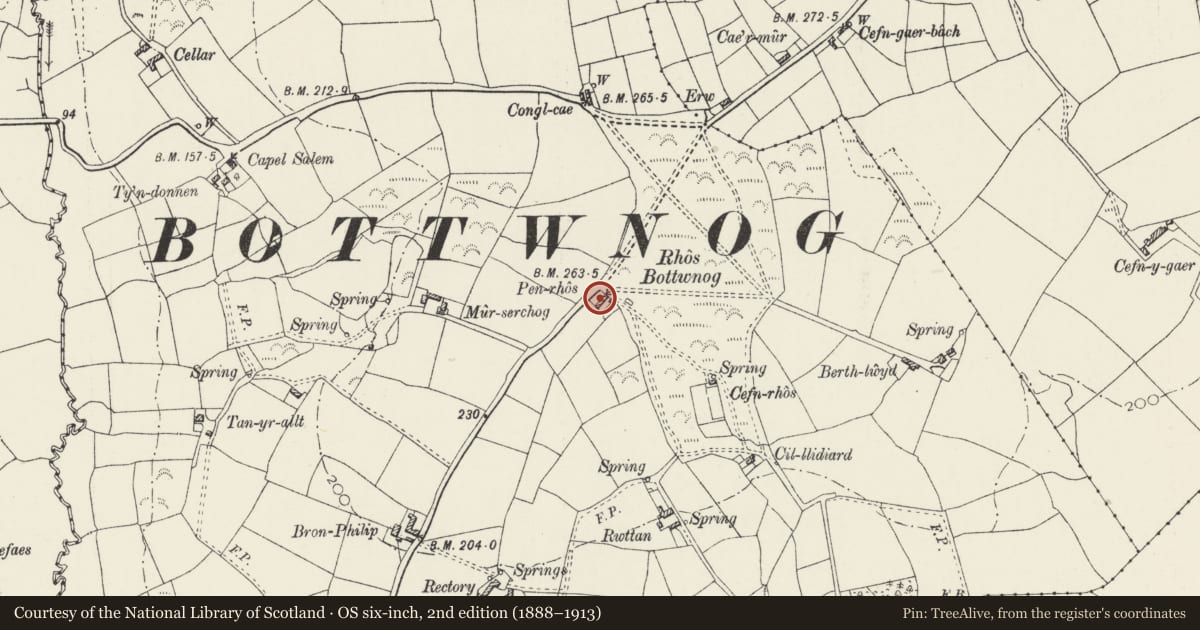
5 historical maps cover this location, the earliest the 1608 map "(13) Cambriae Typus." (David Rumsey Map Collection, Stanford Libraries).
Historical maps covering this location
- 1608 · (13) Cambriae Typus. (David Rumsey Map Collection, Stanford Libraries)
- 1830 · V.3:11-15:XV. Britisches Reich. A. Kon: England. b. Frstenthum Wales: Shire: 37-40 (David Rumsey Map Collection, Stanford Libraries)
- 1883 · Watershed map England, Wales 3. (David Rumsey Map Collection, Stanford Libraries)
- 1899 · 134 Pwllheli (Hills) (David Rumsey Map Collection, Stanford Libraries)
- 1901 · Sheet 9 and 10. (David Rumsey Map Collection, Stanford Libraries)
Cadw's description
Location
Situated on the E side of a lane running N from Botwnnog, on the southern edge of Rhos Botwnnog.
History
Small vernacular farmhouse built on the edge of an area of common ground, probably c1800.
Exterior
Small farmhouse with farmbuilding (animal shelter) built in line. Rubble with grouted small slate roof. Gable end stacks with dripstones, the principal stack to the right. 2 storeys, 2-unit plan with doorway to centre in curved canopy porch. Flanking windows are 4-pane sashes to ground floor, smaller pivoting 4-pane windows above. Small outshut to rear. Forming a continuous build, but at a lower height, the adjoining farmbuilding (probably a cowhouse) to the left, has single window to the left, and 3 doorways.
Reason for designation
Listed as a very well-preserved example of a small farmhouse and attached farmbuilding retaining vernacular character in its simple architectural form and detail. Of a status between the smallholding croglofft cottage and the larger gentry farm, the building represents a significant element in the land economy of the area in the early C19, and retains the character of that period.
Nearby in the register
- Cae MurDomesticunder 1 mi
- Church of St BeunoReligious, Ritual and Funeraryunder 1 mi
- Old SchoolEducationunder 1 mi
- Lon GochDomesticunder 1 mi
Other entries of the same register within about three miles of this one, by straight line.