Cof Cymru: National Historic Assets of Wales · Wales
Walls to Walled Garden at Llanvihangel Court
Crucorney, Monmouthshire, Wales
A Grade II listed building in Llanvihangel Crucorney, Abergavenny, Crucorney, Monmouthshire, designated on 29 January 1998.
The record
- Designation
- Listed building, Grade II
- Broad class
- Domestic
- Date of designation
- 29 January 1998
- Locality
- Llanvihangel Crucorney
- Town
- Abergavenny
- Community
- Crucorney
- Unitary authority
- Monmouthshire
- Country
- Wales
- Coordinates
- 51.87697, -2.97745
- Cadw reference
- 19287
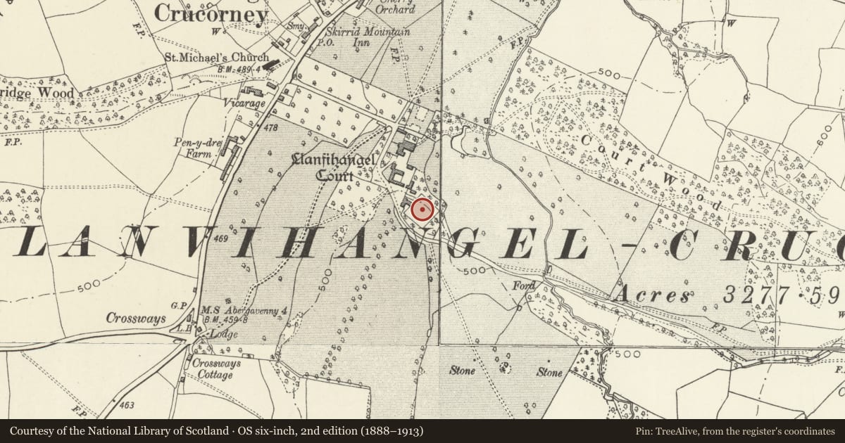
Slide toward Today to fade the historical sheet and see the modern map underneath.
David Rumsey Map Collection, Stanford LibrariesDavid Rumsey Map Collection, Stanford LibrariesDavid Rumsey Map Collection, Stanford LibrariesDavid Rumsey Map Collection, Stanford LibrariesDavid Rumsey Map Collection, Stanford Libraries
5 historical maps cover this location, the earliest the 1636 map "Cornubia : Devonia, Somersetus, Dorcestria, Wiltonia, Glocestria ..." (David Rumsey Map Collection, Stanford Libraries).
Historical maps covering this location
- 1636 · Cornubia : Devonia, Somersetus, Dorcestria, Wiltonia, Glocestria ... (David Rumsey Map Collection, Stanford Libraries)
- 1830 · V.3:11-15:XV.Britisches Reich. A. Kon: England. a. England ab sich: Shire:15-17, 33 (David Rumsey Map Collection, Stanford Libraries)
- 1895 · Sheet 11. Ordnance Survey of England and Wales. (David Rumsey Map Collection, Stanford Libraries)
- 1898 · 232 Abergavenny (Hills) (David Rumsey Map Collection, Stanford Libraries)
- 1901 · Sheet 14. (David Rumsey Map Collection, Stanford Libraries)
Cadw's description
Location
About 70m south east of Llanvihangel Court.
History
A probably late C18 walled garden about 1 acre (0.45 hectare) in area.
Exterior
Red brick in English Garden Wall bond about 3m in height and topped with a stone coping. Plain doorways. It surrounds a roughly square enclosure.
Reason for designation
Included for group value with all the historic buildings at Llanvihangel Court.
Nearby in the register
- Cider House and Cottage at Llanvihangel CourtAgriculture and Subsistenceunder 1 mi
- Stable Block at Llanvihangel CourtDomesticunder 1 mi
- Barn at Llanvihangel CourtAgriculture and Subsistenceunder 1 mi
- Garden House at Llanvihangel CourtDomesticunder 1 mi
Other entries of the same register within about three miles of this one, by straight line.