Cof Cymru: National Historic Assets of Wales · Wales
Calvinistic Methodist Chapel
Crucorney, Monmouthshire, Wales
A Grade II listed building in Pandy, Abergavenny, Crucorney, Monmouthshire, designated on 29 January 1998.
The record
- Designation
- Listed building, Grade II
- Broad class
- Religious, Ritual and Funerary
- Date of designation
- 29 January 1998
- Locality
- Pandy
- Town
- Abergavenny
- Community
- Crucorney
- Unitary authority
- Monmouthshire
- Country
- Wales
- Coordinates
- 51.89257, -2.96979
- Cadw reference
- 19273
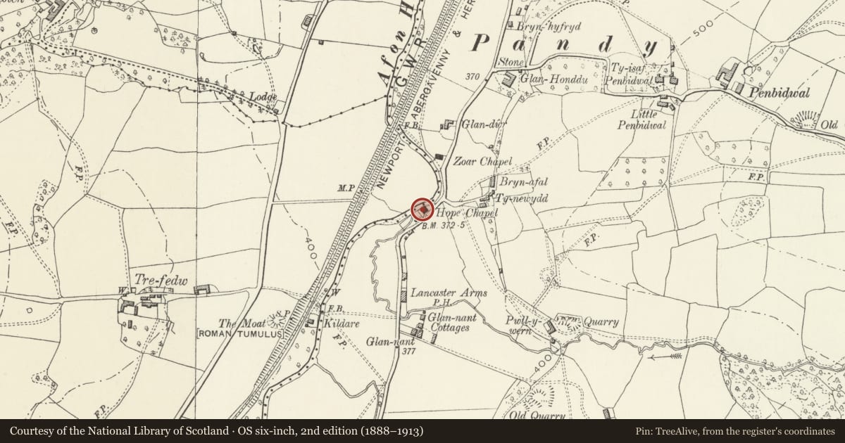
Slide toward Today to fade the historical sheet and see the modern map underneath.
David Rumsey Map Collection, Stanford LibrariesDavid Rumsey Map Collection, Stanford LibrariesDavid Rumsey Map Collection, Stanford LibrariesDavid Rumsey Map Collection, Stanford LibrariesDavid Rumsey Map Collection, Stanford Libraries
5 historical maps cover this location, the earliest the 1636 map "Cornubia : Devonia, Somersetus, Dorcestria, Wiltonia, Glocestria ..." (David Rumsey Map Collection, Stanford Libraries).
Historical maps covering this location
- 1636 · Cornubia : Devonia, Somersetus, Dorcestria, Wiltonia, Glocestria ... (David Rumsey Map Collection, Stanford Libraries)
- 1830 · V.3:11-15:XV.Britisches Reich. A. Kon: England. a. England ab sich: Shire:15-17, 33 (David Rumsey Map Collection, Stanford Libraries)
- 1895 · Sheet 11. Ordnance Survey of England and Wales. (David Rumsey Map Collection, Stanford Libraries)
- 1896 · 214 Talgarth (Hills) (David Rumsey Map Collection, Stanford Libraries)
- 1901 · Sheet 14. (David Rumsey Map Collection, Stanford Libraries)
Cadw's description
Location
In the centre of Pandy about 1.5km north east of St Michael's Church, Llanvihangel Crucorney.
History
A Calvinistic Methodist Chapel built in 1866 and seemingly unchanged since then.
Exterior
Roughly squared uncoursed pink sandstone rubble with freestone quoins and dressings and a Welsh slate roof. Single cell gable ended building. Entrance front has an arched central doorway with a rusticated surround and keyed head. Tall arched windows on either side with long and short quoins, 16 over 20 panes. Rusticated quoin pilasters, string across at frieze level. Pedimented end with scalloped bargeboards. Central roundel with rope mould frame containing inscription
CALVINISTIC
HOPE
1866
METHODIST
Side elevation has two arched windows with 20 panes. Rear gable has bargeboards and quoin pilasters but is otherwise plain while the rear elevation is blind and has a small lean-to.
Interior
The interior is very plain with painted Gothic style pews and the 'set fawr' in a niched alcove.
Reason for designation
Included as an unaltered example of a rural Methodist Chapel of 1866.
Nearby in the register
- The Moat Mound and Bailey Castle, Tre FedwMotte and Baileyunder 1 mi
- Barn at Treveddw FarmAgriculture and Subsistenceunder 1 mi
- Penbidwal Moated SiteMoated Siteunder 1 mi
- Tramway Embankment of Grosmont RailwayEarthwork (unclassified)under 1 mi
Other entries of the same register within about three miles of this one, by straight line.