Cof Cymru: National Historic Assets of Wales · Wales
Terrace walls, steps, garden walls, gatepiers and gates at Trewyn House
Crucorney, Monmouthshire, Wales
A Grade II* listed building in Trewyn, Abergavenny, Crucorney, Monmouthshire, designated on 29 January 1998.
The record
- Designation
- Listed building, Grade II*
- Broad class
- Domestic
- Date of designation
- 29 January 1998
- Locality
- Trewyn
- Town
- Abergavenny
- Community
- Crucorney
- Unitary authority
- Monmouthshire
- Country
- Wales
- Coordinates
- 51.90023, -2.97669
- Cadw reference
- 19260
Slide toward Today to fade the historical sheet and see the modern map underneath.
David Rumsey Map Collection, Stanford LibrariesDavid Rumsey Map Collection, Stanford LibrariesDavid Rumsey Map Collection, Stanford LibrariesDavid Rumsey Map Collection, Stanford LibrariesDavid Rumsey Map Collection, Stanford Libraries
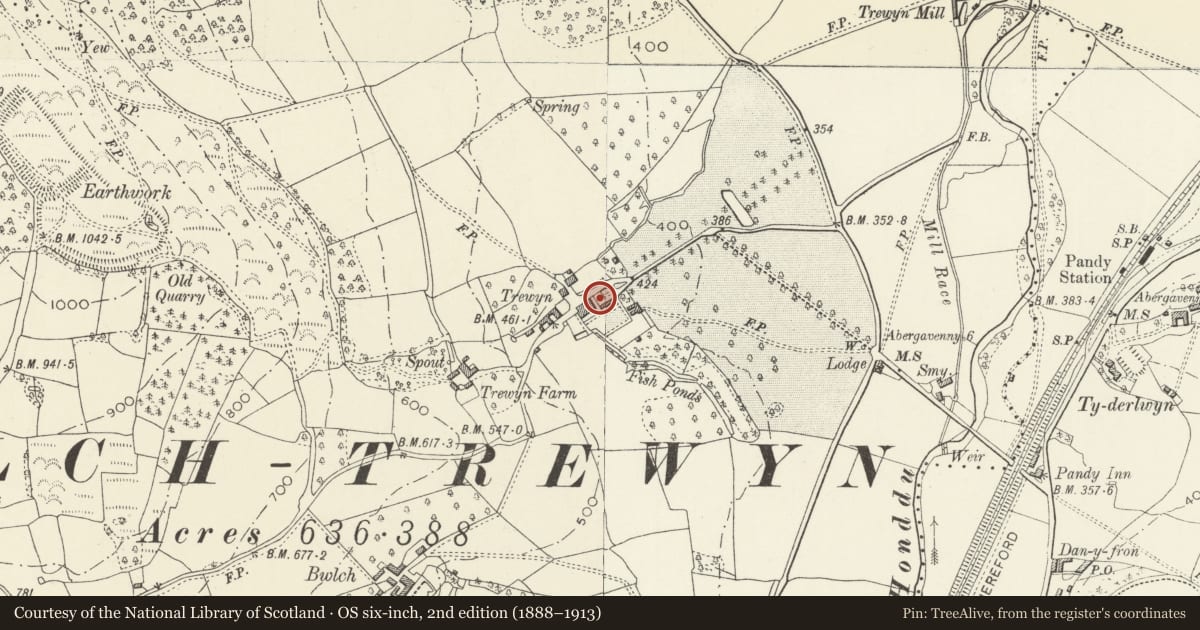
5 historical maps cover this location, the earliest the 1636 map "Cornubia : Devonia, Somersetus, Dorcestria, Wiltonia, Glocestria ..." (David Rumsey Map Collection, Stanford Libraries).
Historical maps covering this location
- 1636 · Cornubia : Devonia, Somersetus, Dorcestria, Wiltonia, Glocestria ... (David Rumsey Map Collection, Stanford Libraries)
- 1830 · V.3:11-15:XV.Britisches Reich. A. Kon: England. a. England ab sich: Shire:15-17, 33 (David Rumsey Map Collection, Stanford Libraries)
- 1895 · Sheet 11. Ordnance Survey of England and Wales. (David Rumsey Map Collection, Stanford Libraries)
- 1896 · 214 Talgarth (Hills) (David Rumsey Map Collection, Stanford Libraries)
- 1901 · Sheet 14. (David Rumsey Map Collection, Stanford Libraries)
Cadw's description
Location
Below the south east front of Trewyn House forming the main approach.
History
Late C17 or early C18; probably closely comntemporary with the house of 1692. Part of a formal garden layout of the period which survives largely in its original form.
Exterior
Red sandstone rubble walls with some red brick, ashlar gatepiers, wrought iron gates. The garden gate piers are square in section and have cornices and carved stone vases with swags. Iron double gates which appear C18. These are flanked by brick dwarf walls topped by spear railings with vases to the main stanchions. The side walls of the courtyard garden are rubble with triangular coping. Two terraces with retaining walls and flights of steps between.
Reason for designation
Listed grade II* for the particular interest of this virtually unaltered late C17/early C18 walled and terraced garden having close group value with the grade II* Trewyn House.
Nearby in the register
- Trewyn HouseDomesticunder 1 mi
- The Manor HouseDomesticunder 1 mi
- Dovecote at Trewyn HouseDomesticunder 1 mi
- Trewyn FarmhouseDomesticunder 1 mi
Other entries of the same register within about three miles of this one, by straight line.