Cof Cymru: National Historic Assets of Wales · Wales
Castell
Cynwyl Gaeo, Carmarthenshire, Wales
A Grade II listed building in Crugybar, Caeo, Cynwyl Gaeo, Carmarthenshire, designated on 20 January 1998.
The record
- Designation
- Listed building, Grade II
- Broad class
- Domestic
- Date of designation
- 20 January 1998
- Locality
- Crugybar
- Town
- Caeo
- Community
- Cynwyl Gaeo
- Unitary authority
- Carmarthenshire
- Country
- Wales
- Coordinates
- 52.02834, -3.94411
- Cadw reference
- 19236
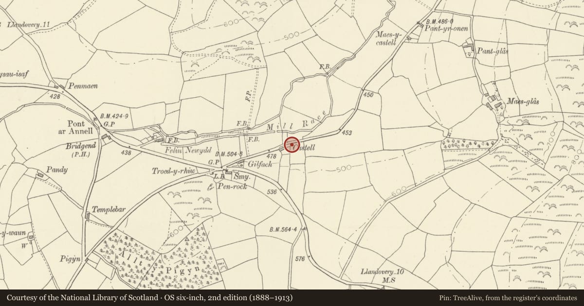
Slide toward Today to fade the historical sheet and see the modern map underneath.
David Rumsey Map Collection, Stanford LibrariesDavid Rumsey Map Collection, Stanford LibrariesDavid Rumsey Map Collection, Stanford LibrariesDavid Rumsey Map Collection, Stanford LibrariesDavid Rumsey Map Collection, Stanford Libraries
5 historical maps cover this location, the earliest the 1860 map "41. Caermathen." (David Rumsey Map Collection, Stanford Libraries).
Historical maps covering this location
- 1860 · 41. Caermathen. (David Rumsey Map Collection, Stanford Libraries)
- 1891 · Sheet 10. Ordnance Survey of England and Wales. . (David Rumsey Map Collection, Stanford Libraries)
- 1898 · 212 Llandovery (Hills) (David Rumsey Map Collection, Stanford Libraries)
- 1898 · 212 Llandovery (Outline) (David Rumsey Map Collection, Stanford Libraries)
- 1901 · Sheet 14. (David Rumsey Map Collection, Stanford Libraries)
Cadw's description
Location
On S side of minor road about 2km SSW of Caio church, about 700m to E of junction of B4302 and A482.
History
Probably early-to-mid C19
Exterior
House. Single-storey. Corrugated roof covering; end chimney stacks. Roughcast symmetrical front, with central doorway (C20 panelled door), square 4-pane window to each side (shallow moulded hoods over openings). Sides and rear in rubble (painted). To L, former byre under corrugated sheet roof; end doorway. Small corrugated lean-to (R). Rear has full width stone outshut with slated and felted roof.
Interior
Said to have 2 rooms with kitchen in outshut; hardboard ceilings, boarded walls. Some lath and plaster visible. Victorian cast iron fireplaces, boarded doors.
Byre said to have exposed collared roof trusses; extensive areas of straw thatch mixed with gorse. Intermediate loft floor supported on beams with wide floor boards. Crude timber planked partition.
Reason for designation
A building in local vernacular tradition, retaining much overall character.
Nearby in the register
- Felin NewyddIndustrialunder 1 mi
- Barn Range at GlanyrannellAgriculture and Subsistenceunder 1 mi
- GlanyrannellDomesticunder 1 mi
- Cowshed at GlanyrannellAgriculture and Subsistenceunder 1 mi
Other entries of the same register within about three miles of this one, by straight line.