Cof Cymru: National Historic Assets of Wales · Wales
Outbuilding to E of Felin Bryn
Eglwyswrw, Pembrokeshire, Wales
A Grade II listed building in Brynberian, Crymych, Eglwyswrw, Pembrokeshire, designated on 10 December 1997.
The record
- Designation
- Listed building, Grade II
- Broad class
- Industrial
- Date of designation
- 10 December 1997
- Locality
- Brynberian
- Town
- Crymych
- Community
- Eglwyswrw
- Unitary authority
- Pembrokeshire
- Country
- Wales
- Coordinates
- 51.98286, -4.76010
- Cadw reference
- 19161
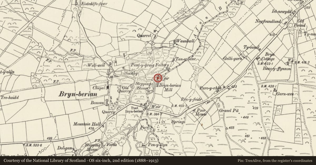
Slide toward Today to fade the historical sheet and see the modern map underneath.
David Rumsey Map Collection, Stanford LibrariesDavid Rumsey Map Collection, Stanford LibrariesDavid Rumsey Map Collection, Stanford LibrariesDavid Rumsey Map Collection, Stanford LibrariesDavid Rumsey Map Collection, Stanford Libraries
5 historical maps cover this location, the earliest the 1636 map "Cornubia : Devonia, Somersetus, Dorcestria, Wiltonia, Glocestria ..." (David Rumsey Map Collection, Stanford Libraries).
Historical maps covering this location
- 1636 · Cornubia : Devonia, Somersetus, Dorcestria, Wiltonia, Glocestria ... (David Rumsey Map Collection, Stanford Libraries)
- 1891 · Sheet 10. Ordnance Survey of England and Wales. . (David Rumsey Map Collection, Stanford Libraries)
- 1898 · 210 Cardigan (Hills) (David Rumsey Map Collection, Stanford Libraries)
- 1898 · 210 Cardigan (Outline) (David Rumsey Map Collection, Stanford Libraries)
- 1901 · Sheet 13. (David Rumsey Map Collection, Stanford Libraries)
Cadw's description
Location
Situated on E side of grassed courtyard in front of Felin Bryn.
History
Early C19 outbuilding, possibly a stable, associated with the mill.
Exterior
Rubble stone with corrugated iron roof over thatch. Small, single-storey with one tiny 4-pane window to left, with slab lintel and full-height doorway to right with slab lintel and stable door. Attached to left is broad cartshed with stone rear and end walls, corrugated iron roof and open front.
Interior
Remains of thatch visible within. Two pegged collar trusses. Single truss to cart-shed, pine pegged collar truss.
Reason for designation
Small vernacular structure which is included for group value with Felin Bryn.
Nearby in the register
- Mill building at Felin BrynIndustrialunder 1 mi
- Brynberian Independent ChapelReligious, Ritual and Funeraryunder 1 mi
- Bedd yr Afanc Burial ChamberChambered Tombunder 1 mi
- Pound at NewfoundlandAgriculture and Subsistenceunder 1 mi
Other entries of the same register within about three miles of this one, by straight line.