Cof Cymru: National Historic Assets of Wales · Wales
Coldstream Lodge
Dale, Pembrokeshire, Wales
A Grade II listed building in Dale, Haverfordwest, Pembrokeshire, designated on 10 December 1997.
The record
- Designation
- Listed building, Grade II
- Broad class
- Domestic
- Date of designation
- 10 December 1997
- Locality
- Dale
- Town
- Haverfordwest
- Community
- Dale
- Unitary authority
- Pembrokeshire
- Country
- Wales
- Coordinates
- 51.70705, -5.17187
- Cadw reference
- 19140
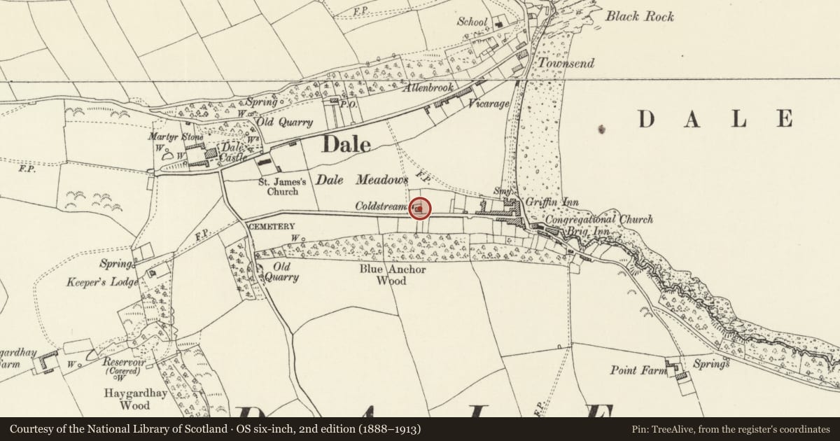
Slide toward Today to fade the historical sheet and see the modern map underneath.
David Rumsey Map Collection, Stanford LibrariesDavid Rumsey Map Collection, Stanford LibrariesDavid Rumsey Map Collection, Stanford LibrariesDavid Rumsey Map Collection, Stanford LibrariesDavid Rumsey Map Collection, Stanford Libraries
5 historical maps cover this location, the earliest the 1636 map "Cornubia : Devonia, Somersetus, Dorcestria, Wiltonia, Glocestria ..." (David Rumsey Map Collection, Stanford Libraries).
Historical maps covering this location
- 1636 · Cornubia : Devonia, Somersetus, Dorcestria, Wiltonia, Glocestria ... (David Rumsey Map Collection, Stanford Libraries)
- 1865 · England and Wales. England No. 6. (David Rumsey Map Collection, Stanford Libraries)
- 1898 · 227 Milford (Hills) (David Rumsey Map Collection, Stanford Libraries)
- 1898 · 227 Milford (Outline) (David Rumsey Map Collection, Stanford Libraries)
- 1901 · Sheet 13. (David Rumsey Map Collection, Stanford Libraries)
Cadw's description
Location
Situated at junction of South Street and Blue Anchor Way on W edge of Dale village.
History
Village house probably of C18 origins remodelled in earlier C19 and restored c1985. Formerly part of the Dale Castle estate.
Exterior
House, painted stucco with slate roof and rendered end stacks, the W chimneybreast external. 2-storey, 4-window range of renewed 12-pane sashes, 16-pane to ground floor left. C19 gabled porch in second bay, painted render with fretted bargeboards and arched entry. C20 door. E end has renewed 4-pane sashes and C20 verge boards. W end has earlier outside stack, indicating that roof has been raised. Rear is outshut with C19 2-storey NW rear wing with brick end stack.
Interior
Entrance hall to 4-flight stair with moulded rail, closed string and stick balusters, possibly later Cl8. 4-panel fielded panel door to right side room, 2 similar to landing. Roof has 6 collar trusses, 3 older in pegged oak, with dove tailed collars, 3 pine. Porch was open and inner door now C20 half-glazed.
Reason for designation
A village house of C18 origins with later C18 stair.
Nearby in the register
- The Reading RoomEducationunder 1 mi
- 2 South StreetDomesticunder 1 mi
- The Griffin InnCommercialunder 1 mi
- Richmond HouseDomesticunder 1 mi
Other entries of the same register within about three miles of this one, by straight line.