Cof Cymru: National Historic Assets of Wales · Wales
The Griffin Inn
Dale, Pembrokeshire, Wales
A Grade II listed building in Dale, Haverfordwest, Pembrokeshire, designated on 10 December 1997.
The record
- Designation
- Listed building, Grade II
- Broad class
- Commercial
- Date of designation
- 10 December 1997
- Locality
- Dale
- Town
- Haverfordwest
- Community
- Dale
- Unitary authority
- Pembrokeshire
- Country
- Wales
- Coordinates
- 51.70716, -5.16885
- Cadw reference
- 19134
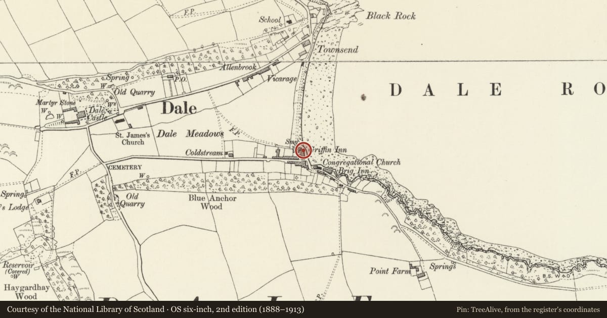
Slide toward Today to fade the historical sheet and see the modern map underneath.
David Rumsey Map Collection, Stanford LibrariesDavid Rumsey Map Collection, Stanford LibrariesDavid Rumsey Map Collection, Stanford LibrariesDavid Rumsey Map Collection, Stanford LibrariesDavid Rumsey Map Collection, Stanford Libraries
5 historical maps cover this location, the earliest the 1636 map "Cornubia : Devonia, Somersetus, Dorcestria, Wiltonia, Glocestria ..." (David Rumsey Map Collection, Stanford Libraries).
Historical maps covering this location
- 1636 · Cornubia : Devonia, Somersetus, Dorcestria, Wiltonia, Glocestria ... (David Rumsey Map Collection, Stanford Libraries)
- 1865 · England and Wales. England No. 6. (David Rumsey Map Collection, Stanford Libraries)
- 1898 · 227 Milford (Hills) (David Rumsey Map Collection, Stanford Libraries)
- 1898 · 227 Milford (Outline) (David Rumsey Map Collection, Stanford Libraries)
- 1901 · Sheet 13. (David Rumsey Map Collection, Stanford Libraries)
Cadw's description
Location
Situated on waterfront at Dale at S end of beach, adjoining Richmond House.
History
Village inn probably of the later C18, owned by the Dale Castle estate.
Exterior
Inn, whitewashed roughcast with slate roof, hipped to N. Large roughcast S end stack, NE roughcast wallface stack and NW whitewashed stone wallface stack. Three-storey, three-window E front of narrow windows. Upper floor has horizontal-sliding casements to outer windows, 4-pane casement centre, first floor has 8-pane horned sashes, ground floor has C20 centre door and broad window each side. Old photographs show similar-sized windows on ground floor to those on first floor. N end wall has hipped centre porch, and had 3-window range, 8-pane sashes to upper floors and small 6-pane to ground floor left and right. Some windows since covered over.
Reason for designation
A later C18 three-storey house of regional Georgian character, dominant on the waterfront at Dale.
Nearby in the register
- Richmond HouseDomesticunder 1 mi
- Eaton HouseDomesticunder 1 mi
- The Reading RoomEducationunder 1 mi
- 2 South StreetDomesticunder 1 mi
Other entries of the same register within about three miles of this one, by straight line.