Cof Cymru: National Historic Assets of Wales · Wales
Central Workshops of City of Cardiff Operational Services.
Grangetown, Cardiff, Wales
A Grade II listed building in Grangetown, Cardiff, designated on 18 November 1997.
The record
- Designation
- Listed building, Grade II
- Broad class
- Transport
- Date of designation
- 18 November 1997
- Community
- Grangetown
- Unitary authority
- Cardiff
- Country
- Wales
- Coordinates
- 51.47526, -3.18601
- Cadw reference
- 19090
Slide toward Today to fade the historical sheet and see the modern map underneath.
David Rumsey Map Collection, Stanford LibrariesDavid Rumsey Map Collection, Stanford LibrariesDavid Rumsey Map Collection, Stanford LibrariesDavid Rumsey Map Collection, Stanford LibrariesDavid Rumsey Map Collection, Stanford Libraries
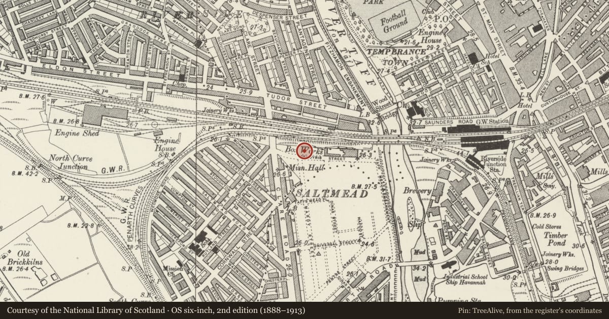
5 historical maps cover this location, the earliest the 1636 map "Cornubia : Devonia, Somersetus, Dorcestria, Wiltonia, Glocestria ..." (David Rumsey Map Collection, Stanford Libraries).
Historical maps covering this location
- 1636 · Cornubia : Devonia, Somersetus, Dorcestria, Wiltonia, Glocestria ... (David Rumsey Map Collection, Stanford Libraries)
- 1865 · England and Wales. England No. 6. (David Rumsey Map Collection, Stanford Libraries)
- 1895 · Sheet 11. Ordnance Survey of England and Wales. (David Rumsey Map Collection, Stanford Libraries)
- 1898 · 263 Cardiff (Hills) (David Rumsey Map Collection, Stanford Libraries)
- 1913 · Sheet 110. Cardiff & Mouth of the Severn. (David Rumsey Map Collection, Stanford Libraries)
Cadw's description
Location
On N side of road, backing on to railway.
History
Built circa 1902 as Clare Road Depot for Cardiff Tram Service. Contractors Messrs D W Davies. In 1923 some alterations to allow trams to enter from S instead of N.
Extensions and alterations by S C Taverner of Newport in 1925. Converted to trolleybus depot 1942, closed to trams 25 August 1946. The depot served routes serving W of City; E routes had been served by larger (demolished) Roath depot
Exterior
Long multi-gabled building in red brick; slate roofs with glass lights, stone copings and kneelers. Eleven gables with louvred oculi. Two bays to each gable generally have 2 arched recesses with lunettes. Second and fifth gables have tall doors; large door between gables 9 and 10. To L, early C20 block links with two-storey 4 window block in red brick. Short screen wall to road.
Interior
Steel truss roof structure.
Reason for designation
Listed as rare surviving large building from a major tramway system, illustrating the transport history of Wales' largest city.
Nearby in the register
- Water Tower at Cardiff Central StationTransportunder 1 mi
- Central Station (Main entrance is in community of Castle)Transportunder 1 mi
- Cardiff Central Station, Booking Hall, Passenger Subway, Platforms 1-4, 6 & 7 and Platform BuildingsTransportunder 1 mi
- Jackson HallRecreationalunder 1 mi
Other entries of the same register within about three miles of this one, by straight line.