Cof Cymru: National Historic Assets of Wales · Wales
Entrance walls and gatepiers to Roch Castle
Nolton and Roch, Pembrokeshire, Wales
A Grade II listed building in Roch, Haverfordwest, Nolton and Roch, Pembrokeshire, designated on 13 November 1997.
The record
- Designation
- Listed building, Grade II
- Broad class
- Gardens, Parks and Urban Spaces
- Date of designation
- 13 November 1997
- Locality
- Roch
- Town
- Haverfordwest
- Community
- Nolton and Roch
- Unitary authority
- Pembrokeshire
- Country
- Wales
- Coordinates
- 51.84866, -5.07973
- Cadw reference
- 19079
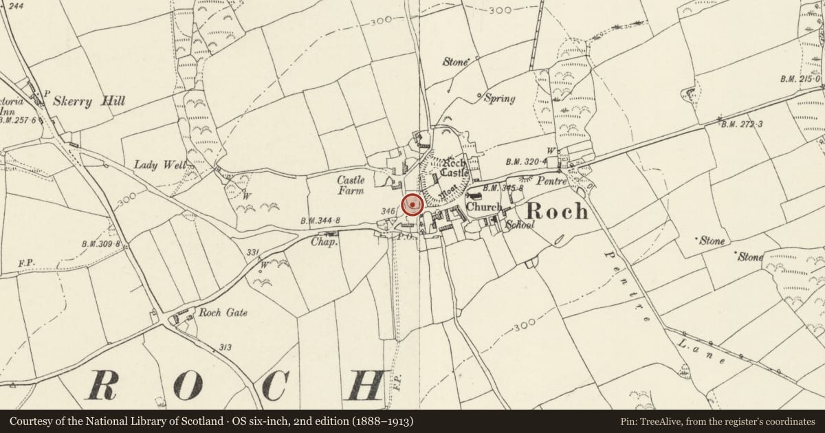
Slide toward Today to fade the historical sheet and see the modern map underneath.
David Rumsey Map Collection, Stanford LibrariesDavid Rumsey Map Collection, Stanford LibrariesDavid Rumsey Map Collection, Stanford LibrariesDavid Rumsey Map Collection, Stanford LibrariesDavid Rumsey Map Collection, Stanford Libraries
5 historical maps cover this location, the earliest the 1608 map "(13) Cambriae Typus." (David Rumsey Map Collection, Stanford Libraries).
Historical maps covering this location
- 1608 · (13) Cambriae Typus. (David Rumsey Map Collection, Stanford Libraries)
- 1636 · Cornubia : Devonia, Somersetus, Dorcestria, Wiltonia, Glocestria ... (David Rumsey Map Collection, Stanford Libraries)
- 1898 · 227 Milford (Outline) (David Rumsey Map Collection, Stanford Libraries)
- 1898 · 227 Milford (Hills) (David Rumsey Map Collection, Stanford Libraries)
- 1901 · Sheet 13. (David Rumsey Map Collection, Stanford Libraries)
Cadw's description
Location
Situated at SW entry to Roch Castle grounds.
History
Early C20 formal approach to Roch Castle, probably of c1904-9 and part of the rebuilding of Roch Castle as a house for Sir J. Wynford Philipps Bt of Picton, later Viscount St Davids. His architect was D.E. Thomas of Haverfordwest. The marble War Memorial plaque was rescued by W.D. Berry, owner of the castle, from the former Wesleyan Methodist Chapel, Roch.
Exterior
Entrance wall and piers, in rock-faced stone with heavy rock-faced string-course and copings. Two gatepiers with wooden gates, then short length of wall each side to two slightly higher large projecting rounded bastions, hollow within. Wall runs some distance to E to terminate at an arched doorway with stone coping ramped over. Reset white marble war memorial plaque to right. Wall continues to W in short curving length.
Reason for designation
Included as a well-designed formal entry to Roch Castle.
Nearby in the register
- Roch CastleDefenceunder 1 mi
- Church of St MaryReligious, Ritual and Funeraryunder 1 mi
- CuffernDomesticunder 1 mi
- Slade CampPromontory Fort - inland1 mi
Other entries of the same register within about three miles of this one, by straight line.