Cof Cymru: National Historic Assets of Wales · Wales
Cuffern
Nolton and Roch, Pembrokeshire, Wales
A Grade II listed building in Cuffern, Haverfordwest, Nolton and Roch, Pembrokeshire, designated on 1 March 1963.
The record
- Designation
- Listed building, Grade II
- Broad class
- Domestic
- Date of designation
- 1 March 1963
- Locality
- Cuffern
- Town
- Haverfordwest
- Community
- Nolton and Roch
- Unitary authority
- Pembrokeshire
- Country
- Wales
- Coordinates
- 51.85071, -5.05863
- Cadw reference
- 12006
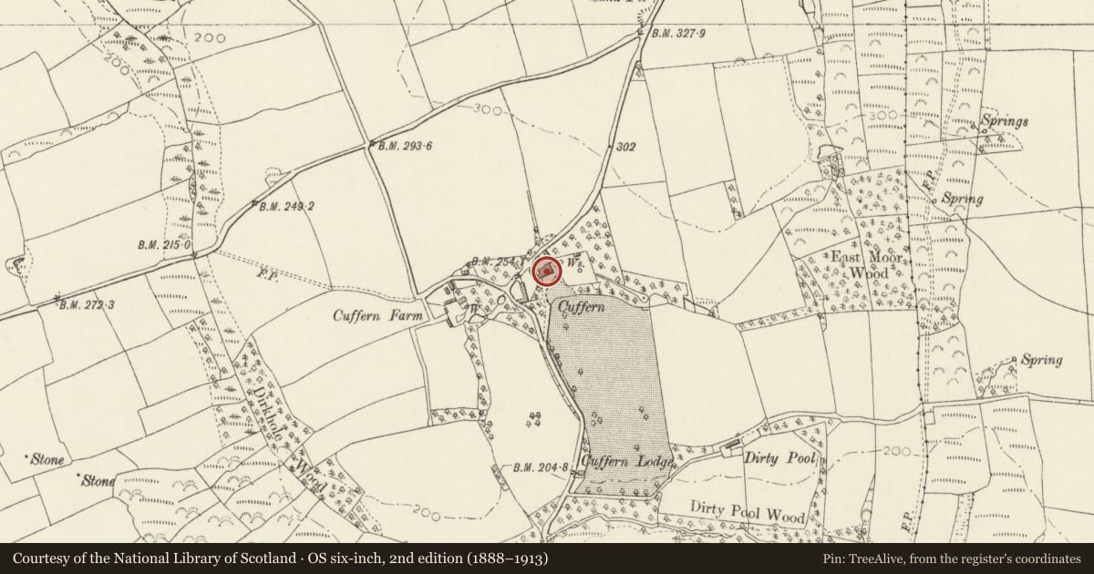
Slide toward Today to fade the historical sheet and see the modern map underneath.
David Rumsey Map Collection, Stanford LibrariesDavid Rumsey Map Collection, Stanford LibrariesDavid Rumsey Map Collection, Stanford LibrariesDavid Rumsey Map Collection, Stanford LibrariesDavid Rumsey Map Collection, Stanford Libraries
5 historical maps cover this location, the earliest the 1608 map "(13) Cambriae Typus." (David Rumsey Map Collection, Stanford Libraries).
Historical maps covering this location
- 1608 · (13) Cambriae Typus. (David Rumsey Map Collection, Stanford Libraries)
- 1636 · Cornubia : Devonia, Somersetus, Dorcestria, Wiltonia, Glocestria ... (David Rumsey Map Collection, Stanford Libraries)
- 1637 · Particular description of Wales. Cambria seu Wallia (David Rumsey Map Collection, Stanford Libraries)
- 1898 · 227 Milford (Outline) (David Rumsey Map Collection, Stanford Libraries)
- 1901 · Sheet 13. (David Rumsey Map Collection, Stanford Libraries)
Cadw's description
Location
Situated some 1.4 km E of Roch, S of the road to Hayscastle.
History
Later C18 country house built for John Rees Stokes about 1770, altered after a fire in 1899. In use as a hotel 1963, converted to a nursing home 1988 with the loss of most of the interior, including presumably the panelled room mentioned in the 1963 listing. Before the 1899 fire the roof was behind a front parapet, as shown in a watercolour of the 1830s.
Exterior
Substantial country house, whitewashed rubble stone (formerly faced in stucco) with imitation slate valley roof with flat eaves and four small end stacks, yellow brick to front range, C20 cement to rear. Three-storey, seven window front with plain plate glass sash windows (without glazing bars) and central door. Stone voussoirs and painted slate sills to windows, C20 half glazed door and fanlight. Crude cement columned porch, probably altered. Right end has 1986 two-storey, one-window addition, rendered. Rear has three-storey, five-window range with stair lights at mezzanine level in centre bay.
Interior
Interior modernised 1986. Panelled room mentioned in 1963 listing has gone. Centre rear staircase survives, dog-leg stair with moulded rail and stick balusters.
Reason for designation
Listed notwithstanding alterations as one of the larger country houses of the area, late C18 in origin.
Nearby in the register
- Church of St MaryReligious, Ritual and Funeraryunder 1 mi
- Slade CampPromontory Fort - inlandunder 1 mi
- Roch CastleDefenceunder 1 mi
- Entrance walls and gatepiers to Roch CastleGardens, Parks and Urban Spacesunder 1 mi
Other entries of the same register within about three miles of this one, by straight line.