Cof Cymru: National Historic Assets of Wales · Wales
Mill at Y Felin
Ceulanamaesmawr, Ceredigion, Wales
A Grade II listed building in Bontgoch/Elerch, Aberystwyth, Ceulanamaesmawr, Ceredigion, designated on 19 September 1997.
The record
- Designation
- Listed building, Grade II
- Broad class
- Industrial
- Date of designation
- 19 September 1997
- Locality
- Bontgoch/Elerch
- Town
- Aberystwyth
- Community
- Ceulanamaesmawr
- Unitary authority
- Ceredigion
- Country
- Wales
- Coordinates
- 52.45865, -3.93956
- Cadw reference
- 18878
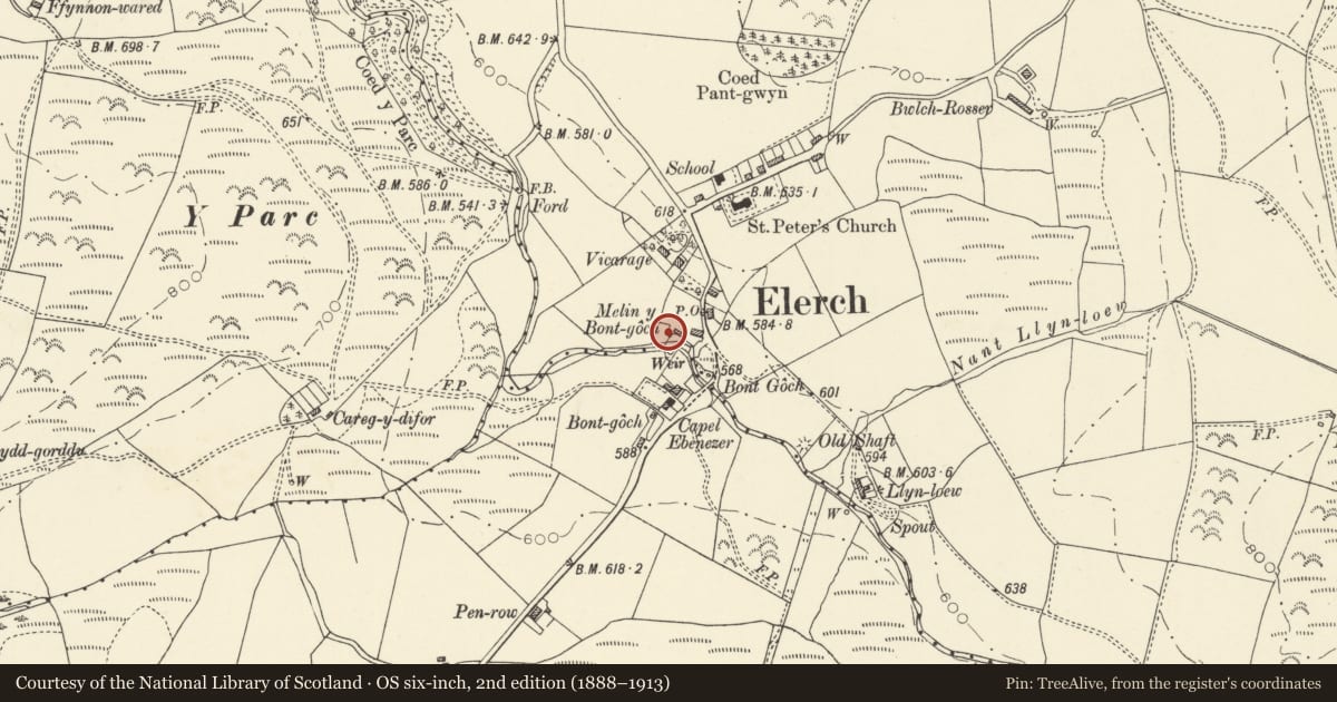
Slide toward Today to fade the historical sheet and see the modern map underneath.
David Rumsey Map Collection, Stanford LibrariesDavid Rumsey Map Collection, Stanford LibrariesDavid Rumsey Map Collection, Stanford LibrariesDavid Rumsey Map Collection, Stanford LibrariesDavid Rumsey Map Collection, Stanford Libraries
5 historical maps cover this location, the earliest the 1830 map "V.3:11-15:XV. Britisches Reich. A. Kon: England. b. Frstenthum Wales: Shire: 37-40" (David Rumsey Map Collection, Stanford Libraries).
Historical maps covering this location
- 1830 · V.3:11-15:XV. Britisches Reich. A. Kon: England. b. Frstenthum Wales: Shire: 37-40 (David Rumsey Map Collection, Stanford Libraries)
- 1883 · Watershed map England, Wales 3. (David Rumsey Map Collection, Stanford Libraries)
- 1896 · Sheet 7. Ordnance Survey of England and Wales. (David Rumsey Map Collection, Stanford Libraries)
- 1899 · 163 Aberystwyth (Hills) (David Rumsey Map Collection, Stanford Libraries)
- 1901 · Sheet 14. (David Rumsey Map Collection, Stanford Libraries)
Cadw's description
Location
Situated above River Leri in Bontgoch just NW of the bridge, and below the house and outbuilding.
History
Mid C19 to later C19 water-powered corn-mill, marked on 1904 OS as Melin Y Bontgoch.
Exterior
Rubble stone with slate roof, single rectangular building built into slope. N side has door into first floor with timber lintel and C20 metal door. W end has ground floor ledged door with brick head. S side has ground floor centre blocked window with brick head and similar first floor centre window. Small casement pair with brick head to ground floor right. E end has large 14' overshot iron wheel made by Davies of Machynlleth. Loft window above.
Interior
Pine floor joists. Remnant of machinery at E end.
Reason for designation
A small rural corn-mill still with surviving machinery, and part of a vernacular group with the house and outbuilding.
Nearby in the register
- Outbuilding at Y FelinMaritimeunder 1 mi
- Y FelinDomesticunder 1 mi
- The Old VicarageDomesticunder 1 mi
- Church of St PeterReligious, Ritual and Funeraryunder 1 mi
Other entries of the same register within about three miles of this one, by straight line.