Cof Cymru: National Historic Assets of Wales · Wales
Hay-barn at Lleweni Farm
Denbigh, Denbighshire, Wales
A Grade II listed building in Lleweni, Denbigh, Denbighshire, designated on 19 September 1997.
The record
- Designation
- Listed building, Grade II
- Broad class
- Agriculture and Subsistence
- Date of designation
- 19 September 1997
- Locality
- Lleweni
- Town
- Denbigh
- Community
- Denbigh
- Unitary authority
- Denbighshire
- Country
- Wales
- Coordinates
- 53.20658, -3.38023
- Cadw reference
- 18869
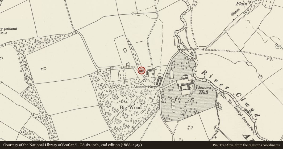
Slide toward Today to fade the historical sheet and see the modern map underneath.
David Rumsey Map Collection, Stanford LibrariesDavid Rumsey Map Collection, Stanford LibrariesLlyfrgell Genedlaethol Cymru – The National Library of WalesDavid Rumsey Map Collection, Stanford LibrariesDavid Rumsey Map Collection, Stanford Libraries
5 historical maps cover this location, the earliest the 1608 map "(13) Cambriae Typus." (David Rumsey Map Collection, Stanford Libraries).
Historical maps covering this location
- 1608 · (13) Cambriae Typus. (David Rumsey Map Collection, Stanford Libraries)
- 1795 · To Sir Watkin Williams-Wynn Bart ... the map of the six counties of North Wales is most… (Llyfrgell Genedlaethol Cymru – The National Library of Wales)
- 1830 · V.3:11-15:XV. Britisches Reich. A. Kon: England. b. Frstenthum Wales: Shire: 37-40 (David Rumsey Map Collection, Stanford Libraries)
- 1883 · Watershed map England, Wales 3. (David Rumsey Map Collection, Stanford Libraries)
- 1901 · Sheet 9 and 10. (David Rumsey Map Collection, Stanford Libraries)
Cadw's description
Location
On elevated site to west of Lleweni Hall which is situated uphill from Lleweni Hall and to NW of the Carriage Yard. Lleweni is to the NE of Denbigh and reached by long drives off the lane from Brookhouse to Waen and from the Mold Road.
History
Later C18 hay-barn built as part of the improvements to the Lleweni Farm, associated with Lleweni Hall which is a multi-period country house now largely demolished.
Exterior
Long open-sided hay barn built in English garden-wall bond red brick on a rubble stone base; brick piers to sides. Eight-bays with corrugated roof. Both gable ends have good brickwork detail including tall round-arched openings and shaped ventilators, lozenge-pattern to east gable and X-pattern to west gable.
Interior
8-bays long with fine king-post trusses with aisle posts. Mostly divided into bays by rubble cross-walls up to approximately 1.5m.
Reason for designation
Listed as a fine, large-scale example of a late C18 estate hay-barn and for its close associations with Lleweni.
Group value with the Carriage-Yard at Lleweni.
Nearby in the register
- Carriage Yard to west of Lleweni HallDomesticunder 1 mi
- Farmyard Range opposite and to west of Lleweni HallAgriculture and Subsistenceunder 1 mi
- Farmyard Range adjoining the north end of Lleweni HallAgriculture and Subsistenceunder 1 mi
- Farmyard Range adjacent to south end of Lleweni HallAgriculture and Subsistenceunder 1 mi
Other entries of the same register within about three miles of this one, by straight line.