Cof Cymru: National Historic Assets of Wales · Wales
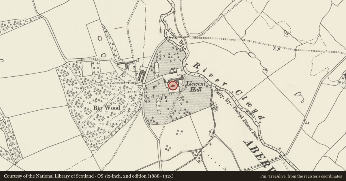
Farmyard Range adjacent to south end of Lleweni Hall
Denbigh, Denbighshire, Wales
A Grade II listed building in Lleweni, Denbigh, Denbighshire, designated on 19 September 1997.
The record
- Designation
- Listed building, Grade II
- Broad class
- Agriculture and Subsistence
- Date of designation
- 19 September 1997
- Locality
- Lleweni
- Town
- Denbigh
- Community
- Denbigh
- Unitary authority
- Denbighshire
- Country
- Wales
- Coordinates
- 53.20557, -3.37628
- Cadw reference
- 18867
Slide toward Today to fade the historical sheet and see the modern map underneath.
David Rumsey Map Collection, Stanford LibrariesDavid Rumsey Map Collection, Stanford LibrariesLlyfrgell Genedlaethol Cymru – The National Library of WalesDavid Rumsey Map Collection, Stanford LibrariesDavid Rumsey Map Collection, Stanford Libraries
5 historical maps cover this location, the earliest the 1608 map "(13) Cambriae Typus." (David Rumsey Map Collection, Stanford Libraries).
Historical maps covering this location
- 1608 · (13) Cambriae Typus. (David Rumsey Map Collection, Stanford Libraries)
- 1795 · To Sir Watkin Williams-Wynn Bart ... the map of the six counties of North Wales is most… (Llyfrgell Genedlaethol Cymru – The National Library of Wales)
- 1830 · V.3:11-15:XV. Britisches Reich. A. Kon: England. b. Frstenthum Wales: Shire: 37-40 (David Rumsey Map Collection, Stanford Libraries)
- 1883 · Watershed map England, Wales 3. (David Rumsey Map Collection, Stanford Libraries)
- 1901 · Sheet 9 and 10. (David Rumsey Map Collection, Stanford Libraries)
Cadw's description
Location
Closes the south side of the farmyard at Lleweni Hall which is situated in its own grounds to north-east of Denbigh and reached via long drives to north and south.
History
C19 service range but possibly reusing brick from those parts of the C18 that had been demolished. Included workshops and stores and a bread oven at the east end; probably built at the time when Lleweni was a large dairy farm especially when it was home to the famous Model Dairy School.
Exterior
Single storey red brick range with slate roof and brick chimney near the east end. Camber-headed doorways with boarded doors and casement windows. Gable end entry into the bay with the massive bread oven.
Interior
The interior has a large bread oven.
Reason for designation
Included for its special interest as one of the ranges of the former Model Dairy School, a pioneering experiment iin rural employment, and as part of the historic Lleweni complex.
Group value with Lleweni Hall and adjacent listed buildings.
Nearby in the register
- Farmyard Range opposite and to west of Lleweni HallAgriculture and Subsistenceunder 1 mi
- Lleweni Hall, including Stables to the NEDomesticunder 1 mi
- Farmyard Range adjoining the north end of Lleweni HallAgriculture and Subsistenceunder 1 mi
- Carriage Yard to west of Lleweni HallDomesticunder 1 mi
Other entries of the same register within about three miles of this one, by straight line.