Cof Cymru: National Historic Assets of Wales · Wales
3 Vicar's Cottages
Pontymoile, Torfaen, Wales
A Grade II listed building in Pontymoile, Pontypool, Torfaen, designated on 28 August 1997.
The record
- Designation
- Listed building, Grade II
- Broad class
- Health and Welfare
- Date of designation
- 28 August 1997
- Locality
- Pontymoile
- Town
- Pontypool
- Community
- Pontymoile
- Unitary authority
- Torfaen
- Country
- Wales
- Coordinates
- 51.69509, -3.02874
- Cadw reference
- 18850
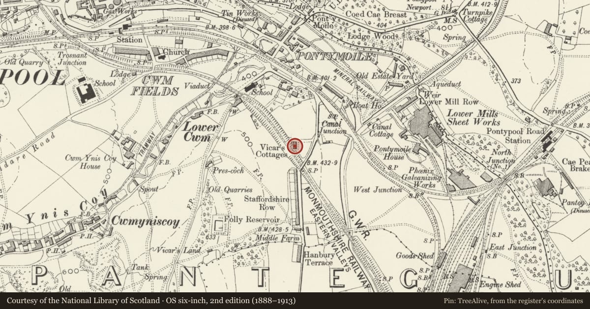
Slide toward Today to fade the historical sheet and see the modern map underneath.
David Rumsey Map Collection, Stanford LibrariesDavid Rumsey Map Collection, Stanford LibrariesDavid Rumsey Map Collection, Stanford LibrariesDavid Rumsey Map Collection, Stanford LibrariesDavid Rumsey Map Collection, Stanford Libraries
5 historical maps cover this location, the earliest the 1636 map "Cornubia : Devonia, Somersetus, Dorcestria, Wiltonia, Glocestria ..." (David Rumsey Map Collection, Stanford Libraries).
Historical maps covering this location
- 1636 · Cornubia : Devonia, Somersetus, Dorcestria, Wiltonia, Glocestria ... (David Rumsey Map Collection, Stanford Libraries)
- 1830 · V.3:11-15:XV.Britisches Reich. A. Kon: England. a. England ab sich: Shire:15-17, 33 (David Rumsey Map Collection, Stanford Libraries)
- 1895 · Sheet 11. Ordnance Survey of England and Wales. (David Rumsey Map Collection, Stanford Libraries)
- 1906 · 249 Newport (Hills) (David Rumsey Map Collection, Stanford Libraries)
- 1913 · Sheet 102. Newport. (David Rumsey Map Collection, Stanford Libraries)
Cadw's description
Location
About 200m south of Pontymoile roundabout.
History
A terrace of three almshouses in the Tudor Revival style which probably date from 1845 and were built by the Pontypool Park estate for employees. They do however appear to be marked on the Panteg tithe map of 1839, so the estate may have refurbished them in 1845, or rebuilt them or just taken them over. Their appearance and architectural character suggests the 1840's.
Interior
Interiors not inspected at the time of resurvey (November 1996).
Reason for designation
An well preserved C19 almshouse group of good design.
Nearby in the register
- 2 Vicar's CottagesHealth and Welfareunder 1 mi
- 1 Vicar's CottagesHealth and Welfareunder 1 mi
- Maesderwen and Maesderwen-bachDomesticunder 1 mi
- Maesderwen Lodge (Pontypool Park estate office)Commercialunder 1 mi
Other entries of the same register within about three miles of this one, by straight line.