Cof Cymru: National Historic Assets of Wales · Wales
Maesderwen Lodge (Pontypool Park estate office)
Pontymoile, Torfaen, Wales
A Grade II listed building in Pontymoile, Pontypool, Torfaen, designated on 28 August 1997.
The record
- Designation
- Listed building, Grade II
- Broad class
- Commercial
- Date of designation
- 28 August 1997
- Locality
- Pontymoile
- Town
- Pontypool
- Community
- Pontymoile
- Unitary authority
- Torfaen
- Country
- Wales
- Coordinates
- 51.69670, -3.02898
- Cadw reference
- 18839
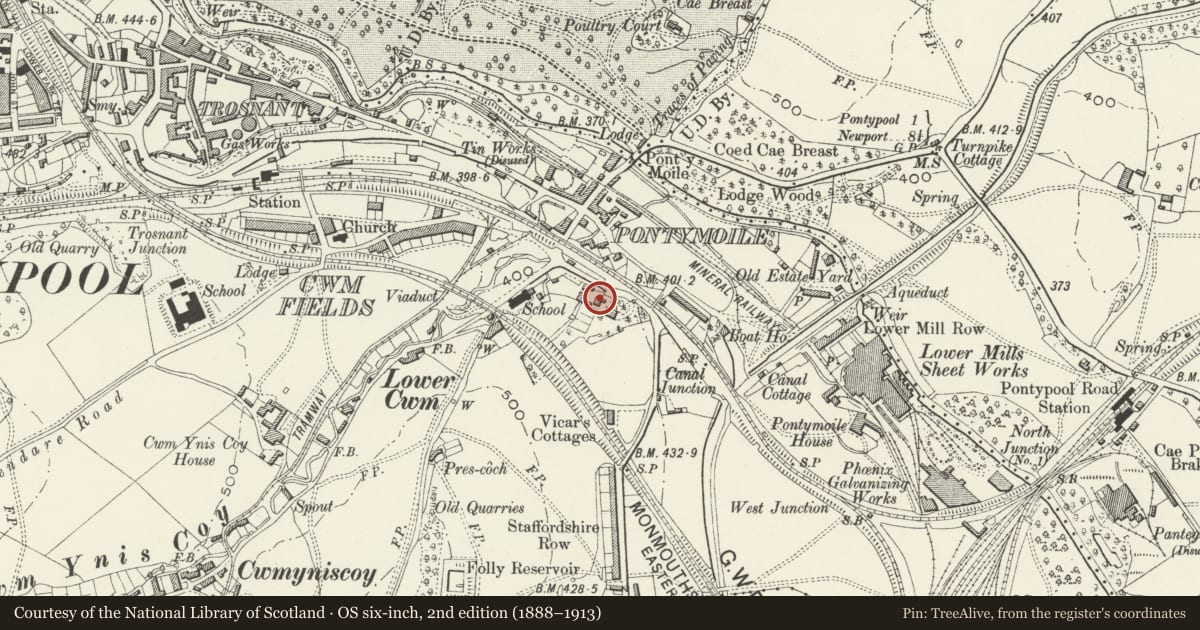
Slide toward Today to fade the historical sheet and see the modern map underneath.
David Rumsey Map Collection, Stanford LibrariesDavid Rumsey Map Collection, Stanford LibrariesDavid Rumsey Map Collection, Stanford LibrariesDavid Rumsey Map Collection, Stanford LibrariesDavid Rumsey Map Collection, Stanford Libraries
5 historical maps cover this location, the earliest the 1636 map "Cornubia : Devonia, Somersetus, Dorcestria, Wiltonia, Glocestria ..." (David Rumsey Map Collection, Stanford Libraries).
Historical maps covering this location
- 1636 · Cornubia : Devonia, Somersetus, Dorcestria, Wiltonia, Glocestria ... (David Rumsey Map Collection, Stanford Libraries)
- 1830 · V.3:11-15:XV.Britisches Reich. A. Kon: England. a. England ab sich: Shire:15-17, 33 (David Rumsey Map Collection, Stanford Libraries)
- 1895 · Sheet 11. Ordnance Survey of England and Wales. (David Rumsey Map Collection, Stanford Libraries)
- 1906 · 249 Newport (Hills) (David Rumsey Map Collection, Stanford Libraries)
- 1913 · Sheet 102. Newport. (David Rumsey Map Collection, Stanford Libraries)
Cadw's description
Location
Overlooking Pontymoile roundabout on the south side.
History
Built as the estate office of Pontypool Park and still used for this purpose. It dates probably from c1900, but is not shown on the O.S. Map of 1901.
Exterior
Small single storey rendered probably brick building with Welsh slate roof. Of plain design except for the street elevation. This has a shaped Dutch gable supported by grooved and partly panelled qouin pilasters. Triple window with arched heads, the outer ones have one over one sashes, the centre one has marginal glazing. Keyed heads with continuous dripmould which dies into an impost band which also divides the quoin pilasters. Bracketted stone cills. Pontypool Park arms in the gable. The side elevation has a tripartite sash, one over one flanking two over two sashes. The other side is attached to a later building, but also has a tripartite sash as above.
Interior
Interior not inspected at the time of resurvey (November 1996).
Reason for designation
Included as an example of a late C19 estate office with group value with other listed buildings in the Pontypool Park estate yard.
Nearby in the register
- Maesderwen and Maesderwen-bachDomesticunder 1 mi
- Coach-house in Pontypool Park estate yard.Transportunder 1 mi
- Mount CottageNo class recordedunder 1 mi
- The Old Truck HouseIndustrialunder 1 mi
Other entries of the same register within about three miles of this one, by straight line.