Cof Cymru: National Historic Assets of Wales · Wales
Agricultural Range at Hafod
Bro Garmon, Conwy, Wales
A Grade II listed building in A470, Bro Garmon, Conwy, designated on 11 August 1997.
The record
- Designation
- Listed building, Grade II
- Broad class
- Agriculture and Subsistence
- Date of designation
- 11 August 1997
- Locality
- A470
- Community
- Bro Garmon
- Unitary authority
- Conwy
- Country
- Wales
- Coordinates
- 53.10956, -3.78359
- Cadw reference
- 18778
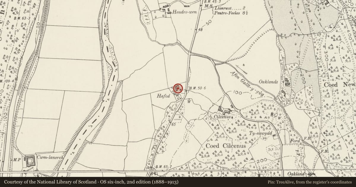
Slide toward Today to fade the historical sheet and see the modern map underneath.
David Rumsey Map Collection, Stanford LibrariesLlyfrgell Genedlaethol Cymru – The National Library of WalesDavid Rumsey Map Collection, Stanford LibrariesDavid Rumsey Map Collection, Stanford LibrariesDavid Rumsey Map Collection, Stanford Libraries
5 historical maps cover this location, the earliest the 1608 map "(13) Cambriae Typus." (David Rumsey Map Collection, Stanford Libraries).
Historical maps covering this location
- 1608 · (13) Cambriae Typus. (David Rumsey Map Collection, Stanford Libraries)
- 1795 · To Sir Watkin Williams-Wynn Bart ... the map of the six counties of North Wales is most… (Llyfrgell Genedlaethol Cymru – The National Library of Wales)
- 1830 · V.3:11-15:XV. Britisches Reich. A. Kon: England. b. Frstenthum Wales: Shire: 37-40 (David Rumsey Map Collection, Stanford Libraries)
- 1883 · Watershed map England, Wales 3. (David Rumsey Map Collection, Stanford Libraries)
- 1901 · Sheet 9 and 10. (David Rumsey Map Collection, Stanford Libraries)
Cadw's description
Location
Located immediately NW of Hafod farmhouse.
History
Tall, rectangular barn, probably built in the early C18 to serve the contemporary farmhouse. Within, however, the trusses of a c1600 timber framed predecessor are incorporated. It is possible that the earlier barn related to the neighbouring Cilcennus, before the lands at Hafod were split off to form a new farm at the beginning of the C18. A later C18 or C19 low byre range adjoins, forming an L-plan with the primary barn; this itself was extended by a further bay in the later C19.
Exterior
Tall, rectangular barn of whitened rubble with medium-pitched old slate roof and tiled ridges; crude stone kneelers to former gable parapets. Boarded stable door in pegged wooden frame to N gable with loading bay above, later reduced and with leaded insert; exposed timber lintels. Large central entrances to sides with stable doors, pegged frames and exposed lintels; that to the E has two sandstone steps. Boarded upper loading bays flank the E entrance and two tiers of ventilation slits are visible (some blocked). A C20 corrugated iron lean-to adjoins to R of the entrance, partly obscuring the right-hand loading bay. 3 tiers of ventilation slits to S gable.
Adjoining the barn to the W, and projecting forward by 2m, a low byre range; construction as before. Boarded stable door in pegged wooden frame to N gable, with loading bay above, later reduced with modern timber window. To the R of the first from L a window (also formerly an entrance), with 8-pane glazing above boarded lower section. Further window (also originally an entrance) before final door. Later, additional bay to far R with small window and door as before. Its rear roof pitch is shallower than that of the main block. Square, plain-glazed window to gable end above modern lean-to; entrance as before to rear.
Interior
3-bay main barn with large, pegged queen strut trusses of c1600 character, with chamfered purlins; the trusses are seated on sections of wall plate, though this is lacking elsewhere on the wall head, indicating probable re-use; morticing evidence to both trusses also suggests that they originated in a a timber-framed building. 5-bay byre section with crude, pegged collar-and-tie-beam trusses and long raking struts; later end bay beyond rubble wall with ceiled loft.
Reason for designation
Listed as a good example of a vernacular agricultural complex of the C17/C18 retaining interesting roof structure.
Group value with other listed items at Hafod.
Nearby in the register
- Carthouse at HafodAgriculture and Subsistenceunder 1 mi
- HafodDomesticunder 1 mi
- CilcennusDomesticunder 1 mi
- Agricultural Range at CilcennusAgriculture and Subsistenceunder 1 mi
Other entries of the same register within about three miles of this one, by straight line.