Cof Cymru: National Historic Assets of Wales · Wales
Road Bridge 60m E of Melin-y-Coed Bridge
Bro Garmon, Conwy, Wales
A Grade II listed building in Melin-y-Coed, Bro Garmon, Conwy, designated on 11 August 1997.
The record
- Designation
- Listed building, Grade II
- Broad class
- Transport
- Date of designation
- 11 August 1997
- Locality
- Melin-y-Coed
- Community
- Bro Garmon
- Unitary authority
- Conwy
- Country
- Wales
- Coordinates
- 53.12811, -3.77225
- Cadw reference
- 18763
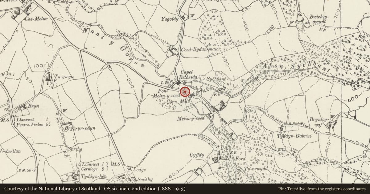
Slide toward Today to fade the historical sheet and see the modern map underneath.
David Rumsey Map Collection, Stanford LibrariesLlyfrgell Genedlaethol Cymru – The National Library of WalesDavid Rumsey Map Collection, Stanford LibrariesDavid Rumsey Map Collection, Stanford LibrariesDavid Rumsey Map Collection, Stanford Libraries
5 historical maps cover this location, the earliest the 1608 map "(13) Cambriae Typus." (David Rumsey Map Collection, Stanford Libraries).
Historical maps covering this location
- 1608 · (13) Cambriae Typus. (David Rumsey Map Collection, Stanford Libraries)
- 1795 · To Sir Watkin Williams-Wynn Bart ... the map of the six counties of North Wales is most… (Llyfrgell Genedlaethol Cymru – The National Library of Wales)
- 1830 · V.3:11-15:XV. Britisches Reich. A. Kon: England. b. Frstenthum Wales: Shire: 37-40 (David Rumsey Map Collection, Stanford Libraries)
- 1883 · Watershed map England, Wales 3. (David Rumsey Map Collection, Stanford Libraries)
- 1901 · Sheet 9 and 10. (David Rumsey Map Collection, Stanford Libraries)
Cadw's description
Location
Spanning the Nant-y-Golon E of Melin-y-Coed bridge in the eponymous hamlet.
History
Road bridge dated 1822 and probably contemporary with the adjoining Melin-y-Coed bridge and its attendant walls; significantly the neighbouring Bethel chapel was also founded in that year.
Exterior
Single-span road bridge of rubble construction with segmental arch; rough-dressed, projecting voussoirs and keystones. Slate-slab coping to rubble parapets, with plain stringcourse below. This is returned onto projecting square end piers at the approaches, those to the upstream side being curved outwards; slight battering to piers. On the road-facing side of the N parapet, the deeply-carved date 1822 with initials T.I; flat carriageway. Attached revetment wall links with Melin-y-Coed bridge.
Reason for designation
Included for group value with Melin-y-Coed bridge and the adjoining revetment walls.
Nearby in the register
- Bethel ChapelReligious, Ritual and Funeraryunder 1 mi
- Melin-y-Coed Bridge and adjoining revetment walls to E and W.Transportunder 1 mi
- Coach House at Cyffdy HallAgriculture and Subsistenceunder 1 mi
- Stable Block at Cyffdy Hall.Agriculture and Subsistenceunder 1 mi
Other entries of the same register within about three miles of this one, by straight line.