Cof Cymru: National Historic Assets of Wales · Wales
Entrance gate and gatepiers at Court Farm
New Inn, Torfaen, Wales
A Grade II listed building in Llanvihangel Pontymoel, Pontypool, New Inn, Torfaen, designated on 7 August 1997.
The record
- Designation
- Listed building, Grade II
- Broad class
- Domestic
- Date of designation
- 7 August 1997
- Locality
- Llanvihangel Pontymoel
- Town
- Pontypool
- Community
- New Inn
- Unitary authority
- Torfaen
- Country
- Wales
- Coordinates
- 51.70543, -3.00825
- Cadw reference
- 18751
Slide toward Today to fade the historical sheet and see the modern map underneath.
David Rumsey Map Collection, Stanford LibrariesDavid Rumsey Map Collection, Stanford LibrariesDavid Rumsey Map Collection, Stanford LibrariesDavid Rumsey Map Collection, Stanford LibrariesDavid Rumsey Map Collection, Stanford Libraries
5 historical maps cover this location, the earliest the 1636 map "Cornubia : Devonia, Somersetus, Dorcestria, Wiltonia, Glocestria ..." (David Rumsey Map Collection, Stanford Libraries).
Historical maps covering this location
- 1636 · Cornubia : Devonia, Somersetus, Dorcestria, Wiltonia, Glocestria ... (David Rumsey Map Collection, Stanford Libraries)
- 1637 · The fourth table of England. Cornub. Devonia, Somerset etc. (David Rumsey Map Collection, Stanford Libraries)
- 1830 · V.3:11-15:XV.Britisches Reich. A. Kon: England. a. England ab sich: Shire:15-17, 33 (David Rumsey Map Collection, Stanford Libraries)
- 1895 · Sheet 11. Ordnance Survey of England and Wales. (David Rumsey Map Collection, Stanford Libraries)
- 1913 · Sheet 102. Newport. (David Rumsey Map Collection, Stanford Libraries)
Cadw's description
Location
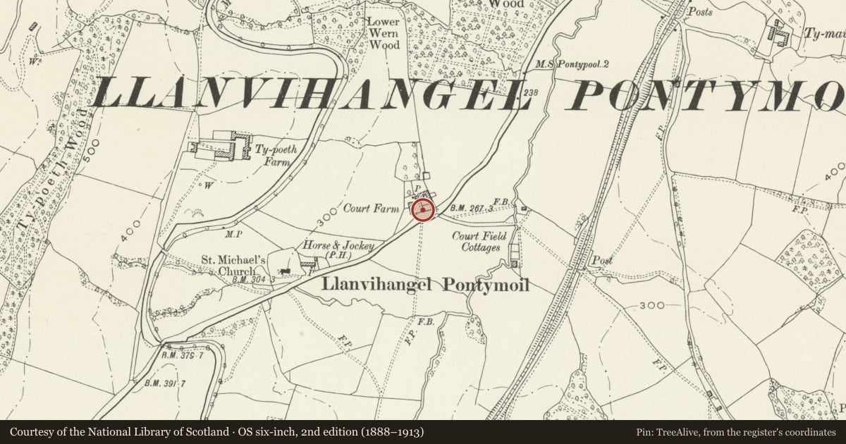
Immediately on the north side of the junction of Usk Road and the A4042 and approached by a drive beside The Horse and Jockey P.H.
History
An early C19 gate to a smart farmyard. One of the improvements following the purchase of the farm by the Pontypool Park estate in the early C19 during the ownership of Capel Hanbury Leigh (1795-1861).
Exterior
Cast and wrought iron gate and gatepiers. Solid cast square section piers capped by neo-classical urns. The piers are surrounded in the form of a square by wrought posts and these support the wrought 7-bar gate with strainers from the corners to the centre of the top and bottom bars. Cast rosettes at the cross-overs and small vases on the side posts. Rising butts to allow it to open in both directions.
Reason for designation
Included for group value with Court Farmhouse and the other listed buildings at this especially well preserved farm.
Nearby in the register
- Large Barn at Court FarmAgriculture and Subsistenceunder 1 mi
- Cowhouse at Court FarmAgriculture and Subsistenceunder 1 mi
- Court FarmhouseDomesticunder 1 mi
- Small Barn at Court FarmAgriculture and Subsistenceunder 1 mi
Other entries of the same register within about three miles of this one, by straight line.