Cof Cymru: National Historic Assets of Wales · Wales
Hawthorn House
Menai Bridge, Isle of Anglesey, Wales
A Grade II listed building in Menai Bridge, Isle of Anglesey, designated on 18 July 1997.
The record
- Designation
- Listed building, Grade II
- Broad class
- Domestic
- Date of designation
- 18 July 1997
- Town
- Menai Bridge
- Community
- Menai Bridge
- Unitary authority
- Isle of Anglesey
- Country
- Wales
- Coordinates
- 53.22647, -4.16255
- Cadw reference
- 18551
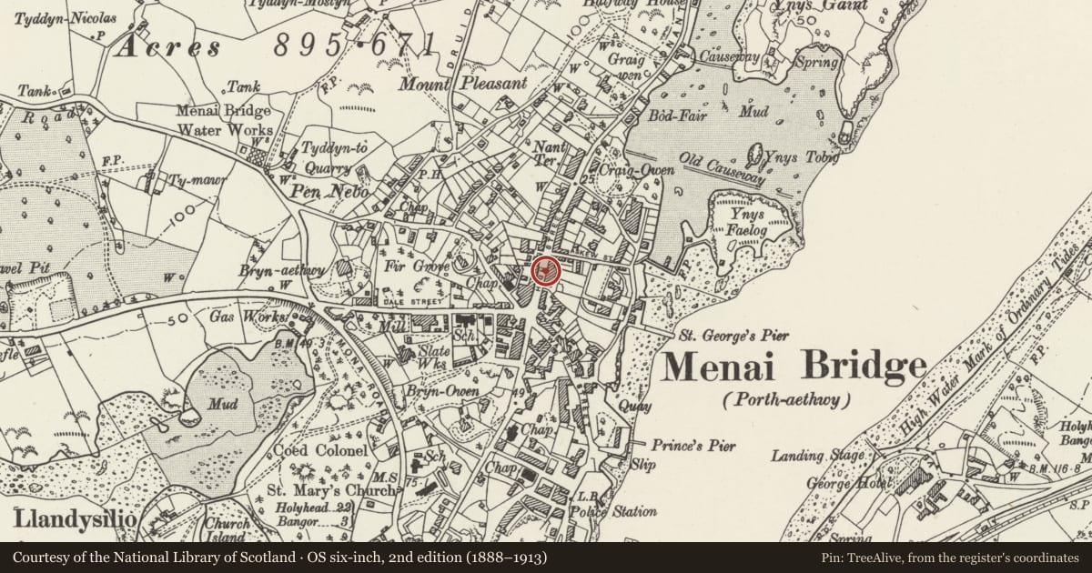
Slide toward Today to fade the historical sheet and see the modern map underneath.
David Rumsey Map Collection, Stanford LibrariesDavid Rumsey Map Collection, Stanford LibrariesDavid Rumsey Map Collection, Stanford LibrariesDavid Rumsey Map Collection, Stanford LibrariesDavid Rumsey Map Collection, Stanford Libraries
5 historical maps cover this location, the earliest the 1896 map "Sheet 7. Ordnance Survey of England and Wales." (David Rumsey Map Collection, Stanford Libraries).
Historical maps covering this location
- 1896 · Sheet 7. Ordnance Survey of England and Wales. (David Rumsey Map Collection, Stanford Libraries)
- 1899 · 106 Bangor (Outline) (David Rumsey Map Collection, Stanford Libraries)
- 1899 · 106 Bangor (Hills) (David Rumsey Map Collection, Stanford Libraries)
- 1901 · Sheet 9 and 10. (David Rumsey Map Collection, Stanford Libraries)
- 1919 · Sheet 41. Anglesey. (David Rumsey Map Collection, Stanford Libraries)
Cadw's description
Location
Prominently sited on the High Street of Menai Bridge, breaking the roofline of 2 storey houses either side. Set slightly back from the road, behind a modern wall, with a wide entrance to one side leading to an enclosed yard to rear.
History
Probably early C19, pre-dating the surrounding mid-late C19 development of Menai Bridge. Formerly a farmhouse, it became a commercial premises when J O Hughes and Son established a painting business in 1888, for which it is still used.
Exterior
Large town-house, principal elevation a 3 storeyed, 3 window range with central entrance. Kitchen addition in wing to rear. Rendered walls with imitation ashlar scoring, slate roof with rendered stacks either end. Doorway in fine lattice-work porch with modillion cornice. Windows are mainly 16-pane sashes (12-pane to attic storey) in strongly moulded architraves. Attached to left is a covered carriageway with wide boarded door incorporating a 2 storey and attic, 2 window range. Upper storey with single sash window, off-centre, fixed light in the attic storey above. Lower storey with 16-pane sash window to left. Carriageway leads to enclosed, flagged yard with former stables and 2 bay cartshed, all with lofts or granaries over.
Reason for designation
Listed as a very well-preserved early C19 house distinctive for its scale in the streetscape, as well as for the fine quality of its detailing.
Nearby in the register
- MilestoneTransportunder 1 mi
- Trinity HouseDomesticunder 1 mi
- No 2 Tan BrynDomesticunder 1 mi
- No 1 Tan BrynDomesticunder 1 mi
Other entries of the same register within about three miles of this one, by straight line.