Cof Cymru: National Historic Assets of Wales · Wales
No 1 Tan Bryn
Menai Bridge, Isle of Anglesey, Wales
A Grade II listed building in Menai Bridge, Isle of Anglesey, designated on 18 July 1997.
The record
- Designation
- Listed building, Grade II
- Broad class
- Domestic
- Date of designation
- 18 July 1997
- Town
- Menai Bridge
- Community
- Menai Bridge
- Unitary authority
- Isle of Anglesey
- Country
- Wales
- Coordinates
- 53.22524, -4.16292
- Cadw reference
- 18549
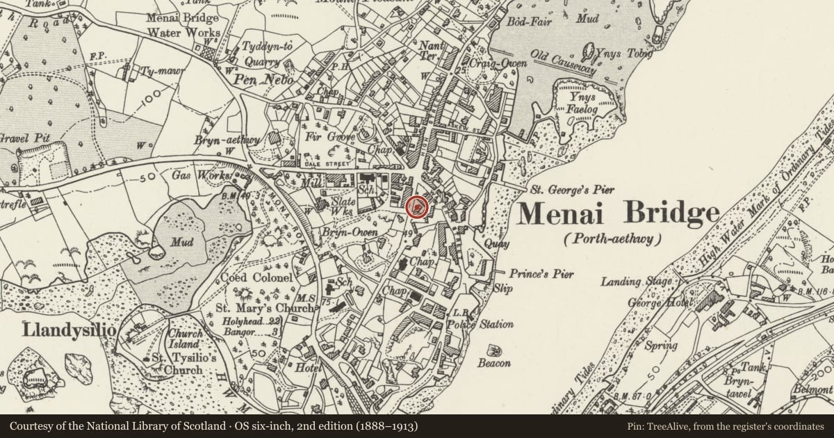
Slide toward Today to fade the historical sheet and see the modern map underneath.
David Rumsey Map Collection, Stanford LibrariesDavid Rumsey Map Collection, Stanford LibrariesDavid Rumsey Map Collection, Stanford LibrariesDavid Rumsey Map Collection, Stanford LibrariesDavid Rumsey Map Collection, Stanford Libraries
5 historical maps cover this location, the earliest the 1896 map "Sheet 7. Ordnance Survey of England and Wales." (David Rumsey Map Collection, Stanford Libraries).
Historical maps covering this location
- 1896 · Sheet 7. Ordnance Survey of England and Wales. (David Rumsey Map Collection, Stanford Libraries)
- 1899 · 106 Bangor (Outline) (David Rumsey Map Collection, Stanford Libraries)
- 1899 · 106 Bangor (Hills) (David Rumsey Map Collection, Stanford Libraries)
- 1901 · Sheet 9 and 10. (David Rumsey Map Collection, Stanford Libraries)
- 1919 · Sheet 41. Anglesey. (David Rumsey Map Collection, Stanford Libraries)
Cadw's description
Location
Situated close to the centre of Menai Bridge. The houses are slightly set back from and at an angle to the road, with small gardens to the front enclosed by a low wall and railings.
History
Early to mid C19 house, built during one of the first phases of growth of Menai Bridge.
Reason for designation
A well proportioned pair of houses in a simple villa form, retaining many original features, and reflecting the early development of Menai Bridge following the construction of the bridge in the early C19.
Nearby in the register
- No 2 Tan BrynDomesticunder 1 mi
- Victoria HotelCommercialunder 1 mi
- Trinity HouseDomesticunder 1 mi
- St. George's Pier Booking Office and gatesMaritimeunder 1 mi
Other entries of the same register within about three miles of this one, by straight line.