Cof Cymru: National Historic Assets of Wales · Wales
Aberbechan Aqueduct
Llandyssil, Powys, Wales
A Grade II listed building in Aberbechan, Llandyssil, Powys, designated on 14 July 1997.
The record
- Designation
- Listed building, Grade II
- Broad class
- Water Supply and Drainage
- Date of designation
- 14 July 1997
- Locality
- Aberbechan
- Community
- Llandyssil
- Unitary authority
- Powys
- Country
- Wales
- Coordinates
- 52.53268, -3.26578
- Cadw reference
- 18540
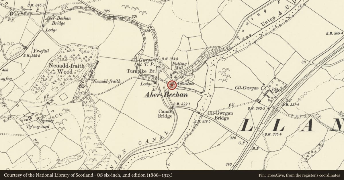
Slide toward Today to fade the historical sheet and see the modern map underneath.
David Rumsey Map Collection, Stanford LibrariesDavid Rumsey Map Collection, Stanford LibrariesDavid Rumsey Map Collection, Stanford LibrariesLlyfrgell Genedlaethol Cymru – The National Library of WalesDavid Rumsey Map Collection, Stanford Libraries
5 historical maps cover this location, the earliest the 1637 map "Particular description of Wales. Cambria seu Wallia" (David Rumsey Map Collection, Stanford Libraries).
Historical maps covering this location
- 1637 · Particular description of Wales. Cambria seu Wallia (David Rumsey Map Collection, Stanford Libraries)
- 1795 · To Sir Watkin Williams-Wynn Bart ... the map of the six counties of North Wales is most… (Llyfrgell Genedlaethol Cymru – The National Library of Wales)
- 1883 · Watershed map England, Wales 3. (David Rumsey Map Collection, Stanford Libraries)
- 1899 · 165 Montgomery (Hills) (David Rumsey Map Collection, Stanford Libraries)
- 1901 · Sheet 14. (David Rumsey Map Collection, Stanford Libraries)
Cadw's description
Location
Carries the Montgomeryshire Canal over the Bechan Brook on the boundary of Llandyssil and Newtown Communities.
History
The western branch of the Montgomeryshire Canal from Garthmyl to Newtown was built between 1815 and 1819-21 (Josiah Jessop, engineer, John Williams, builder). The original aqueduct at Aberbechan was repaired in 1859, collapsed and was rebuilt re-using much of the original facing stone, probably in the same year. There is also evidence of later C19 repair.
Exterior
Three-arched masonry aqueduct. Planned on a concave curve over the Bechan Brook, and comprising 3 segmental arches. Finely dressed stone, with hoodmoulds and a string course over the arches. Main central arch flanked by keeled cutwaters, from which spring pilasters articulating the high stone-faced wall of the trough above the arches. This wall terminates in a plain cornice, with simple cast-iron railings on the tow-path side.
Reason for designation
Included as a fine example of a small masonry aqueduct, and an important element in the engineering of the Montgomeryshire Canal.
Nearby in the register
- Cilgwrgan BridgeTransportunder 1 mi
- CilgwrganDomesticunder 1 mi
- Aberbechan BridgeTransportunder 1 mi
- Aberbechan Bridge (partly in Newtown & Llanllwchaiarn community)Transportunder 1 mi
Other entries of the same register within about three miles of this one, by straight line.