Cof Cymru: National Historic Assets of Wales · Wales
Bridge 150 over the Montgomeryshire Canal
Llandyssil, Powys, Wales
A Grade II listed building in Dolforwyn, Llandyssil, Powys, designated on 14 July 1997.
The record
- Designation
- Listed building, Grade II
- Broad class
- Transport
- Date of designation
- 14 July 1997
- Locality
- Dolforwyn
- Community
- Llandyssil
- Unitary authority
- Powys
- Country
- Wales
- Coordinates
- 52.53959, -3.25468
- Cadw reference
- 18536
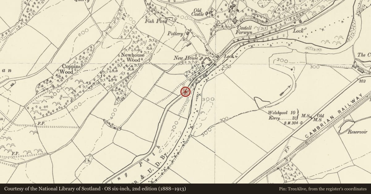
Slide toward Today to fade the historical sheet and see the modern map underneath.
David Rumsey Map Collection, Stanford LibrariesDavid Rumsey Map Collection, Stanford LibrariesDavid Rumsey Map Collection, Stanford LibrariesLlyfrgell Genedlaethol Cymru – The National Library of WalesDavid Rumsey Map Collection, Stanford Libraries
5 historical maps cover this location, the earliest the 1637 map "Particular description of Wales. Cambria seu Wallia" (David Rumsey Map Collection, Stanford Libraries).
Historical maps covering this location
- 1637 · Particular description of Wales. Cambria seu Wallia (David Rumsey Map Collection, Stanford Libraries)
- 1795 · To Sir Watkin Williams-Wynn Bart ... the map of the six counties of North Wales is most… (Llyfrgell Genedlaethol Cymru – The National Library of Wales)
- 1883 · Watershed map England, Wales 3. (David Rumsey Map Collection, Stanford Libraries)
- 1899 · 165 Montgomery (Hills) (David Rumsey Map Collection, Stanford Libraries)
- 1901 · Sheet 14. (David Rumsey Map Collection, Stanford Libraries)
Cadw's description
Location
Located approximately 200m SW of Bridge 149 and its adjoining lock. The bridge carries a farm track linking two fields.
History
One of a group of ‘fish-bellied’ iron bridges probably designed and constructed by George Buck, engineer of the Montgomeryshire Canal. He was engineer of the Western branch in 1832-3, but bridges of this type were built up to c1850.
Exterior
Cast-iron ‘fish-bellied’ beam bridge. There are 5 original beams supporting a renewed deck with plywood soffit. The parapets consist of timber posts and 3 rows of modern steel rails. The iron beams sit on splayed brick abutments with sandstone copings and padstones. Immediately to the S are cast iron rebates for stop planks, and a sandstone block with iron ring no doubt for attaching boats. Beyond is a weir with wooden planks, leading down to the W.
Reason for designation
Listed as one of a small group of ‘fish-bellied’ iron bridges over the Montgomeryshire Canal. These bridges represent the early use of girders of this characteristic shape, designed to compensate for the low tensile strength of cast iron.
Nearby in the register
- Bridge 149 over the Montgomeryshire Canal and LockTransportunder 1 mi
- Castle CottageDomesticunder 1 mi
- Bridge 148 and Byles LockTransportunder 1 mi
- Castell DolforwynCastleunder 1 mi
Other entries of the same register within about three miles of this one, by straight line.