Cof Cymru: National Historic Assets of Wales · Wales
Principal entrance gates to Saint Issell's Churchyard
Saundersfoot, Pembrokeshire, Wales
A Grade II listed building in Churchton, Saundersfoot, Pembrokeshire, designated on 7 May 1997.
The record
- Designation
- Listed building, Grade II
- Broad class
- Religious, Ritual and Funerary
- Date of designation
- 7 May 1997
- Locality
- Churchton
- Community
- Saundersfoot
- Unitary authority
- Pembrokeshire
- Country
- Wales
- Coordinates
- 51.71955, -4.70492
- Cadw reference
- 18447
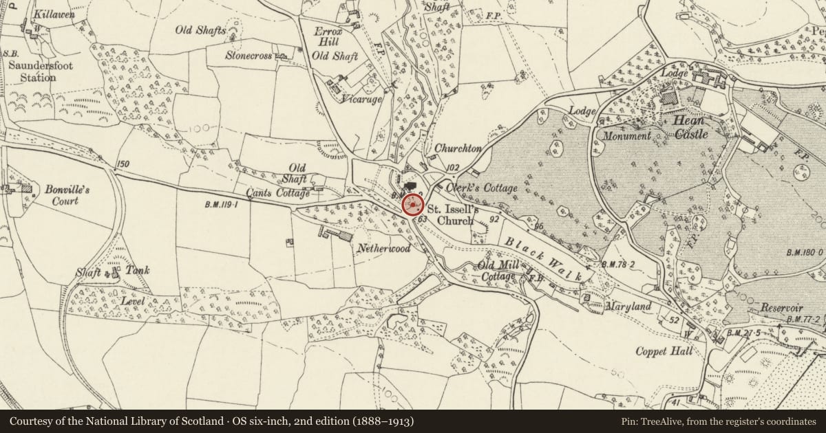
Slide toward Today to fade the historical sheet and see the modern map underneath.
David Rumsey Map Collection, Stanford LibrariesDavid Rumsey Map Collection, Stanford LibrariesDavid Rumsey Map Collection, Stanford LibrariesDavid Rumsey Map Collection, Stanford LibrariesDavid Rumsey Map Collection, Stanford Libraries
5 historical maps cover this location, the earliest the 1636 map "Cornubia : Devonia, Somersetus, Dorcestria, Wiltonia, Glocestria ..." (David Rumsey Map Collection, Stanford Libraries).
Historical maps covering this location
- 1636 · Cornubia : Devonia, Somersetus, Dorcestria, Wiltonia, Glocestria ... (David Rumsey Map Collection, Stanford Libraries)
- 1637 · The fourth table of England. Cornub. Devonia, Somerset etc. (David Rumsey Map Collection, Stanford Libraries)
- 1891 · Sheet 10. Ordnance Survey of England and Wales. . (David Rumsey Map Collection, Stanford Libraries)
- 1898 · 228 Haverfordwest (Hills) (David Rumsey Map Collection, Stanford Libraries)
- 1901 · Sheet 13. (David Rumsey Map Collection, Stanford Libraries)
Cadw's description
Location
Forms the main entrance to the churchyard, close to the war memorial.
History
The church was extensively restored 1862-64 and the churchyard gates were probably erected at this time, said to have been fabricated at the Kilgetty ironworks.
Exterior
Pair of wrought iron gates with cast iron finials square stone gate piers with simple square moulding and shallow pyramidal copings. Each gate has hinge style of square section, with elaborate cast iron finial, and rectangular section, pierced by round uprights. These terminate in ornate spear-head finials, with scrolled cresting. Shorter uprights below the lock-bar terminate in bared finials.
Reason for designation
Listed as one of a series of fine iron entrance gates to the churchyard, which represent good examples of locally produced ironwork.
Nearby in the register
- St Issell's ChurchReligious, Ritual and Funeraryunder 1 mi
- Preaching Cross at St. Issell's ChurchReligious, Ritual and Funeraryunder 1 mi
- Rear gates to Saint Issell's ChurchyardReligious, Ritual and Funeraryunder 1 mi
- North gates to Saint Issell's churchyardReligious, Ritual and Funeraryunder 1 mi
Other entries of the same register within about three miles of this one, by straight line.