Cof Cymru: National Historic Assets of Wales · Wales
Preaching Cross at St. Issell's Church
Saundersfoot, Pembrokeshire, Wales
A Grade II listed building in Churchton, Saundersfoot, Pembrokeshire, designated on 7 May 1997.
The record
- Designation
- Listed building, Grade II
- Broad class
- Religious, Ritual and Funerary
- Date of designation
- 7 May 1997
- Locality
- Churchton
- Community
- Saundersfoot
- Unitary authority
- Pembrokeshire
- Country
- Wales
- Coordinates
- 51.72009, -4.70488
- Cadw reference
- 18443
Slide toward Today to fade the historical sheet and see the modern map underneath.
David Rumsey Map Collection, Stanford LibrariesDavid Rumsey Map Collection, Stanford LibrariesDavid Rumsey Map Collection, Stanford LibrariesDavid Rumsey Map Collection, Stanford LibrariesDavid Rumsey Map Collection, Stanford Libraries
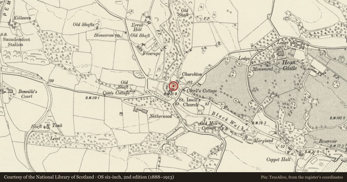
5 historical maps cover this location, the earliest the 1636 map "Cornubia : Devonia, Somersetus, Dorcestria, Wiltonia, Glocestria ..." (David Rumsey Map Collection, Stanford Libraries).
Historical maps covering this location
- 1636 · Cornubia : Devonia, Somersetus, Dorcestria, Wiltonia, Glocestria ... (David Rumsey Map Collection, Stanford Libraries)
- 1637 · The fourth table of England. Cornub. Devonia, Somerset etc. (David Rumsey Map Collection, Stanford Libraries)
- 1891 · Sheet 10. Ordnance Survey of England and Wales. . (David Rumsey Map Collection, Stanford Libraries)
- 1898 · 228 Haverfordwest (Hills) (David Rumsey Map Collection, Stanford Libraries)
- 1901 · Sheet 13. (David Rumsey Map Collection, Stanford Libraries)
Cadw's description
Location
In the churchyard of St Issell's at the N side of the church, on sloping ground.
Exterior
A mediaeval preaching cross, in sandstone, about 1.5 m in height, consisting of a worn shaft with arms on a socket-stone and plinth. It is on a base of three roughly-constructed steps. The shaft and the arms are of octagonal section. At the foot of the octagonal section are broach-stops and the lower part of the shaft is square.
Reason for designation
Listed as a significant surviving example of a medieval preaching cross, and for group value with st. Issells's Church.
Nearby in the register
- St Issell's ChurchReligious, Ritual and Funeraryunder 1 mi
- Rear gates to Saint Issell's ChurchyardReligious, Ritual and Funeraryunder 1 mi
- Principal entrance gates to Saint Issell's ChurchyardReligious, Ritual and Funeraryunder 1 mi
- North gates to Saint Issell's churchyardReligious, Ritual and Funeraryunder 1 mi
Other entries of the same register within about three miles of this one, by straight line.