Cof Cymru: National Historic Assets of Wales · Wales
Briardene Cottage
Penrice, Swansea, Wales
A Grade II listed building in Oxwich, Penrice, Swansea, designated on 30 April 1997.
The record
- Designation
- Listed building, Grade II
- Broad class
- Domestic
- Date of designation
- 30 April 1997
- Locality
- Oxwich
- Community
- Penrice
- Unitary authority
- Swansea
- Country
- Wales
- Coordinates
- 51.55879, -4.17072
- Cadw reference
- 18424
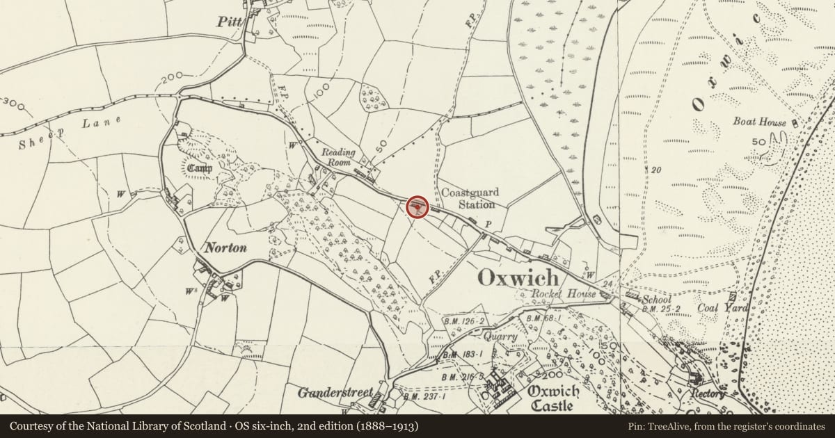
Slide toward Today to fade the historical sheet and see the modern map underneath.
David Rumsey Map Collection, Stanford LibrariesDavid Rumsey Map Collection, Stanford LibrariesDavid Rumsey Map Collection, Stanford LibrariesDavid Rumsey Map Collection, Stanford LibrariesDavid Rumsey Map Collection, Stanford Libraries
5 historical maps cover this location, the earliest the 1636 map "Cornubia : Devonia, Somersetus, Dorcestria, Wiltonia, Glocestria ..." (David Rumsey Map Collection, Stanford Libraries).
Historical maps covering this location
- 1636 · Cornubia : Devonia, Somersetus, Dorcestria, Wiltonia, Glocestria ... (David Rumsey Map Collection, Stanford Libraries)
- 1637 · The fourth table of England. Cornub. Devonia, Somerset etc. (David Rumsey Map Collection, Stanford Libraries)
- 1865 · England and Wales. England No. 6. (David Rumsey Map Collection, Stanford Libraries)
- 1891 · Sheet 10. Ordnance Survey of England and Wales. . (David Rumsey Map Collection, Stanford Libraries)
- 1907 · 246 Worms Head (Hills) (David Rumsey Map Collection, Stanford Libraries)
Cadw's description
Location
About 400m NNW of Oxwich Castle, on S side of main village street.
History
Late C17/early C18 house, formerly a farm in the Penrice estates; additional cottage added to W, early C19; now all one house. The house has remains of charnel box above fireplace in main room (in existence within living memory). The box was used to smoke bacon etc and is a Gower feature which illustrates cultural links with N Devon, where the charnel box is also known.
Exterior
House. Two storeys. Rubble, colourwashed, corrugated roof covering replacing thatch, chimneys to ends and centre. Asymmetrical front has, towards L, doorway with 2 windows above, and window to each side. To R, further doorway with small first floor window to R. Small lean-to to R. To rear 3 stone buttresses; 2 deeply-set windows to first floor, 3 deeply-set windows to ground floor.
Interior
Main room has fireplace with stop-chamfered beam; above fireplace, framing for charnel box; to L of fireplace, beginnings of stone spiral stair. Stop-chamfered beam to ceiling
Reason for designation
Listed as late C17/ early C18 house illustrating cultural links across the Severn Estuary, and making a contribution to the conservation area.
Nearby in the register
- Margaret's CottageDomesticunder 1 mi
- The Nook and The CottageDomesticunder 1 mi
- Limekiln in Oxwich WoodIndustrialunder 1 mi
- Limestone Quarry and Kiln at OxwichLimekilnunder 1 mi
Other entries of the same register within about three miles of this one, by straight line.