Cof Cymru: National Historic Assets of Wales · Wales
Margaret's Cottage
Penrice, Swansea, Wales
A Grade II listed building in Oxwich, Penrice, Swansea, designated on 17 December 1992.
The record
- Designation
- Listed building, Grade II
- Broad class
- Domestic
- Date of designation
- 17 December 1992
- Locality
- Oxwich
- Community
- Penrice
- Unitary authority
- Swansea
- Country
- Wales
- Coordinates
- 51.55847, -4.16890
- Cadw reference
- 11733
Slide toward Today to fade the historical sheet and see the modern map underneath.
David Rumsey Map Collection, Stanford LibrariesDavid Rumsey Map Collection, Stanford LibrariesDavid Rumsey Map Collection, Stanford LibrariesDavid Rumsey Map Collection, Stanford LibrariesDavid Rumsey Map Collection, Stanford Libraries
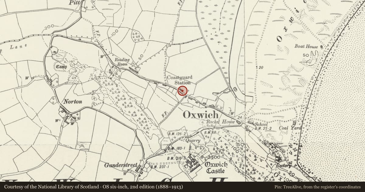
5 historical maps cover this location, the earliest the 1636 map "Cornubia : Devonia, Somersetus, Dorcestria, Wiltonia, Glocestria ..." (David Rumsey Map Collection, Stanford Libraries).
Historical maps covering this location
- 1636 · Cornubia : Devonia, Somersetus, Dorcestria, Wiltonia, Glocestria ... (David Rumsey Map Collection, Stanford Libraries)
- 1637 · The fourth table of England. Cornub. Devonia, Somerset etc. (David Rumsey Map Collection, Stanford Libraries)
- 1865 · England and Wales. England No. 6. (David Rumsey Map Collection, Stanford Libraries)
- 1891 · Sheet 10. Ordnance Survey of England and Wales. . (David Rumsey Map Collection, Stanford Libraries)
- 1907 · 246 Worms Head (Hills) (David Rumsey Map Collection, Stanford Libraries)
Cadw's description
Location
Towards the western end of Oxwich village, on the north side of the village street. Narrow flowerbed strip at road edge at front, with stone border.
History
Margaret's Cottage, which was formerly known as Rose Cottage, is said to have been built as an estate cottage belonging to Penrice Castle (which was built in 1770s). It does not appear to be shown on the Penrice estate map by J Williams dated 1783, but a building is indicated in the position on the map of 1813. Modern renovation.
Exterior
Two-storey, two-window whitewashed rubble cottage with straw-thatched roof including 'eyebrows' to the front. Four-pane casement windows above and below and low boarded door (1.7m high) to centre, with flood board. Remains of cobbled paving. Projecting slated chimney breast to left end. Corrugated-iron roofed garage extension beyond, converted from an outhouse which had a gable chimney, now truncated; later lean-to at right with steel-frame window and further door. Said to have a camber-headed half-glazed central door to rear.
Reason for designation
Listed as a small vernacular cottage which has retained its character and makes a contribution to the conservation area.
Nearby in the register
- The Nook and The CottageDomesticunder 1 mi
- Briardene CottageDomesticunder 1 mi
- Limekiln in Oxwich WoodIndustrialunder 1 mi
- Limestone Quarry and Kiln at OxwichLimekilnunder 1 mi
Other entries of the same register within about three miles of this one, by straight line.