Cof Cymru: National Historic Assets of Wales · Wales
22 Ogwen Terrace
Bethesda, Gwynedd, Wales
A Grade II listed building in Bethesda, Bangor, Gwynedd, designated on 25 April 1997.
The record
- Designation
- Listed building, Grade II
- Broad class
- Domestic
- Date of designation
- 25 April 1997
- Locality
- Bethesda
- Town
- Bangor
- Community
- Bethesda
- Unitary authority
- Gwynedd
- Country
- Wales
- Coordinates
- 53.17903, -4.05938
- Cadw reference
- 18394
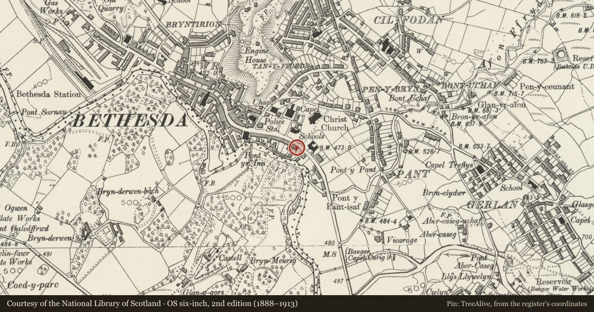
Slide toward Today to fade the historical sheet and see the modern map underneath.
David Rumsey Map Collection, Stanford LibrariesDavid Rumsey Map Collection, Stanford LibrariesDavid Rumsey Map Collection, Stanford LibrariesDavid Rumsey Map Collection, Stanford LibrariesDavid Rumsey Map Collection, Stanford Libraries
5 historical maps cover this location, the earliest the 1896 map "Sheet 7. Ordnance Survey of England and Wales." (David Rumsey Map Collection, Stanford Libraries).
Historical maps covering this location
- 1896 · Sheet 7. Ordnance Survey of England and Wales. (David Rumsey Map Collection, Stanford Libraries)
- 1899 · 106 Bangor (Hills) (David Rumsey Map Collection, Stanford Libraries)
- 1899 · 106 Bangor (Outline) (David Rumsey Map Collection, Stanford Libraries)
- 1901 · Sheet 9 and 10. (David Rumsey Map Collection, Stanford Libraries)
- 1919 · Sheet 41. Anglesey. (David Rumsey Map Collection, Stanford Libraries)
Cadw's description
Location
Situated at E end of terrace of 22 houses on A 5 in centre of Bethesda.
History
Terrace house of c1830-40, part of an extensive curved terrace fronting onto the turnpike road to Holyhead. Terrace is slightly stepped and No 22 is part of a single block with the three houses to the right. The terrace appears to have been built in connection with Telford's road to Holyhead, to an urban scale remarkable in what was primarily a slate-quarrying settlement.
Exterior
Roughcast with slate roof and roughcast large end stack to left, and corniced slate stack, shared with No 21 to right. Three-storey, two-window range, hornless sashes, 9-pane to upper floor, 12-pane to first and ground floors, the ground floor windows larger. First and second floor sill-bands, ground floor slate sills. Four-panel door with overlight to right. Projecting stones on left corner indicate that terrace was to have been continued.
Reason for designation
One of several houses that retain original character in a fine late Georgian curved terrace of unusual scale.
Nearby in the register
- The Douglas Arms Hotel including railingsCommercialunder 1 mi
- 17 Ogwen TerraceDomesticunder 1 mi
- The War Memorial and surrounding wall.Commemorativeunder 1 mi
- 10 Ogwen TerraceDomesticunder 1 mi
Other entries of the same register within about three miles of this one, by straight line.