Cof Cymru: National Historic Assets of Wales · Wales
8 High Street
Rhosddu, Wrexham, Wales
A Grade II listed building in Rhosddu, Wrexham, designated on 16 June 1980.
The record
- Designation
- Listed building, Grade II
- Broad class
- Commercial
- Date of designation
- 16 June 1980
- Community
- Rhosddu
- Unitary authority
- Wrexham
- Country
- Wales
- Coordinates
- 53.04527, -2.99253
- Cadw reference
- 1839
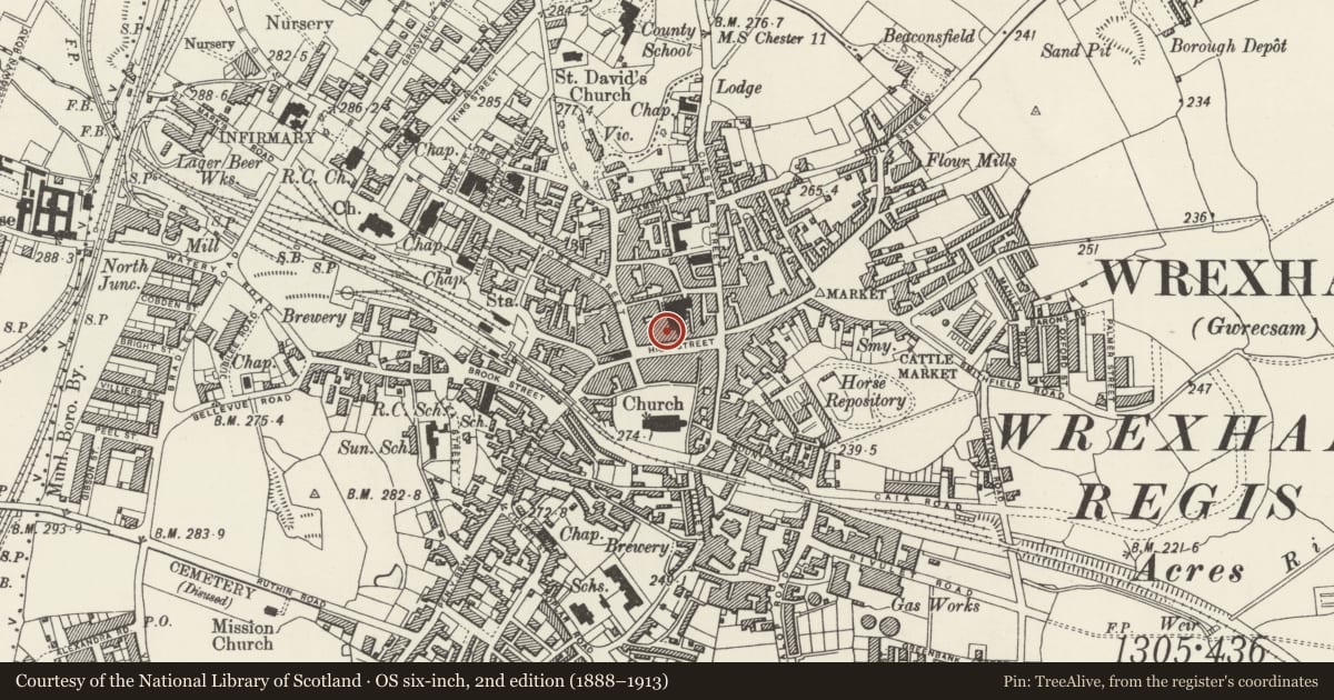
Slide toward Today to fade the historical sheet and see the modern map underneath.
David Rumsey Map Collection, Stanford LibrariesDavid Rumsey Map Collection, Stanford LibrariesDavid Rumsey Map Collection, Stanford LibrariesDavid Rumsey Map Collection, Stanford LibrariesDavid Rumsey Map Collection, Stanford Libraries
5 historical maps cover this location, the earliest the 1608 map "(13) Cambriae Typus." (David Rumsey Map Collection, Stanford Libraries).
Historical maps covering this location
- 1608 · (13) Cambriae Typus. (David Rumsey Map Collection, Stanford Libraries)
- 1883 · Watershed map England, Wales 3. (David Rumsey Map Collection, Stanford Libraries)
- 1898 · 121 Wrexham (Hills) (David Rumsey Map Collection, Stanford Libraries)
- 1898 · 121 Wrexham (Outline) (David Rumsey Map Collection, Stanford Libraries)
- 1901 · Sheet 9 and 10. (David Rumsey Map Collection, Stanford Libraries)
Cadw's description
Location
Immediately W of the Butchers' Market building.
History
Palmer noted the first documentary record of a building on the site by 1699, and it had been divided into 2 properties by 1760. The present building probably dates from the late C18, and appears to have been designed to take some account of its divided occupation, since it incorporates a central passage, unequally dividing the ground floor.
Exterior
Lined-out render over brick, with slate roof and gable end brick stacks. 3 storeys, 3 window range with 2 shop fronts to ground floor, either side of doorway to passage. No 9 retains an early C19 shop front, its central entrance and flanking windows stressed by panelled pilasters with heavy console brackets carrying (and interupting) the fascia. Upper windows originally 12-pane sashes (some glazing bars now removed).
Simply moulded eaves cornice.
Interior
No 9 retains some of the elements of the early C19 shop, including plaster dentilled cornice to ceiling and Palladian archway on the line of the back wall, which originally probably formed part of a display wall, but now marks a division in the opened-out floor-space.
Nearby in the register
- 9 High StreetCommercialunder 1 mi
- 10 High StreetCommercialunder 1 mi
- Butcher's MarketCommercialunder 1 mi
- Central ArcadeCommercialunder 1 mi
Other entries of the same register within about three miles of this one, by straight line.