Cof Cymru: National Historic Assets of Wales · Wales
Agricultural Complex at Pant Glas
Ysbyty Ifan, Conwy, Wales
A Grade II listed building in Pant Glas, Ysbyty Ifan, Conwy, designated on 8 April 1997.
The record
- Designation
- Listed building, Grade II
- Broad class
- Agriculture and Subsistence
- Date of designation
- 8 April 1997
- Locality
- Pant Glas
- Community
- Ysbyty Ifan
- Unitary authority
- Conwy
- Country
- Wales
- Coordinates
- 53.04556, -3.72312
- Cadw reference
- 18331
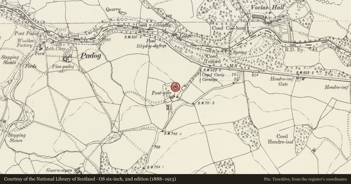
Slide toward Today to fade the historical sheet and see the modern map underneath.
David Rumsey Map Collection, Stanford LibrariesDavid Rumsey Map Collection, Stanford LibrariesLlyfrgell Genedlaethol Cymru – The National Library of WalesDavid Rumsey Map Collection, Stanford LibrariesDavid Rumsey Map Collection, Stanford Libraries
5 historical maps cover this location, the earliest the 1795 map "To Sir Watkin Williams-Wynn Bart ... the map of the six counties of North Wales is most humbly inscribed by his obedient humble servant" (Llyfrgell Genedlaethol Cymru – The National Library of Wales).
Historical maps covering this location
- 1795 · To Sir Watkin Williams-Wynn Bart ... the map of the six counties of North Wales is most… (Llyfrgell Genedlaethol Cymru – The National Library of Wales)
- 1830 · V.3:11-15:XV. Britisches Reich. A. Kon: England. b. Frstenthum Wales: Shire: 37-40 (David Rumsey Map Collection, Stanford Libraries)
- 1883 · Watershed map England, Wales 3. (David Rumsey Map Collection, Stanford Libraries)
- 1898 · 120 Corwen (Hills) (David Rumsey Map Collection, Stanford Libraries)
- 1901 · Sheet 9 and 10. (David Rumsey Map Collection, Stanford Libraries)
Cadw's description
Location
Located 100m to the N of Pant Glas farmhouse on a commanding hill-top site above the road.
History
Agricultural complex dated 1883; built as part of a series of estate improvements and rebuilding works carried out by Lord Penrhyn of Penrhyn Castle, who acquired the Ysbyty Ifan and Eidda estates in the 1850s.
Exterior
Large, planned agricultural complex, built around a quadrangular part-cobbled courtyard. Of rubble construction with some rough-dressed stone re-used from the demolished ranges of the former Pant Glas mansion to the W; hipped slate roofs with tiled ridges, machine-cut slate lintels and cills. The complex consists of a large, symmetrical 4-bay corn barn to the N with low byre and stable ranges advancing as flanking wings to the E and W; the courtyard is accessed from the S between two further storeyed blocks, that on the E side bearing a small datestone (1883). Large central entrance to corn barn with flanking tiered ventilation slits; C20 lean-to addition to R with corrugated asbestos roof, further entrance beyond. 2 large cart entrances to western front block; a 3-bay pigsty with slated roof adjoins to front of E block. The front blocks have upper haylofts accessed from the courtyard via external flights of coped, parapetted steps, that to the E rebuilt 1996.
Reason for designation
Included as an exceptionally good example of a C19 estate-built agricultural complex with group value with Pant Glas farmhouse.
Nearby in the register
- Pant Glas FarmhouseDomesticunder 1 mi
- Pont Rhyd-y-DyfrgiTransportunder 1 mi
- Pont Rhyd-y-DyfrgiTransportunder 1 mi
- Driveway bridge at Voelas (partly in Bro Garmon community)Gardens, Parks and Urban Spacesunder 1 mi
Other entries of the same register within about three miles of this one, by straight line.