Cof Cymru: National Historic Assets of Wales · Wales
Pont Caletwr
Ysbyty Ifan, Conwy, Wales
A Grade II listed building in Plas Uchaf, Ysbyty Ifan, Conwy, designated on 8 April 1997.
The record
- Designation
- Listed building, Grade II
- Broad class
- Transport
- Date of designation
- 8 April 1997
- Locality
- Plas Uchaf
- Community
- Ysbyty Ifan
- Unitary authority
- Conwy
- Country
- Wales
- Coordinates
- 53.02945, -3.70533
- Cadw reference
- 18330
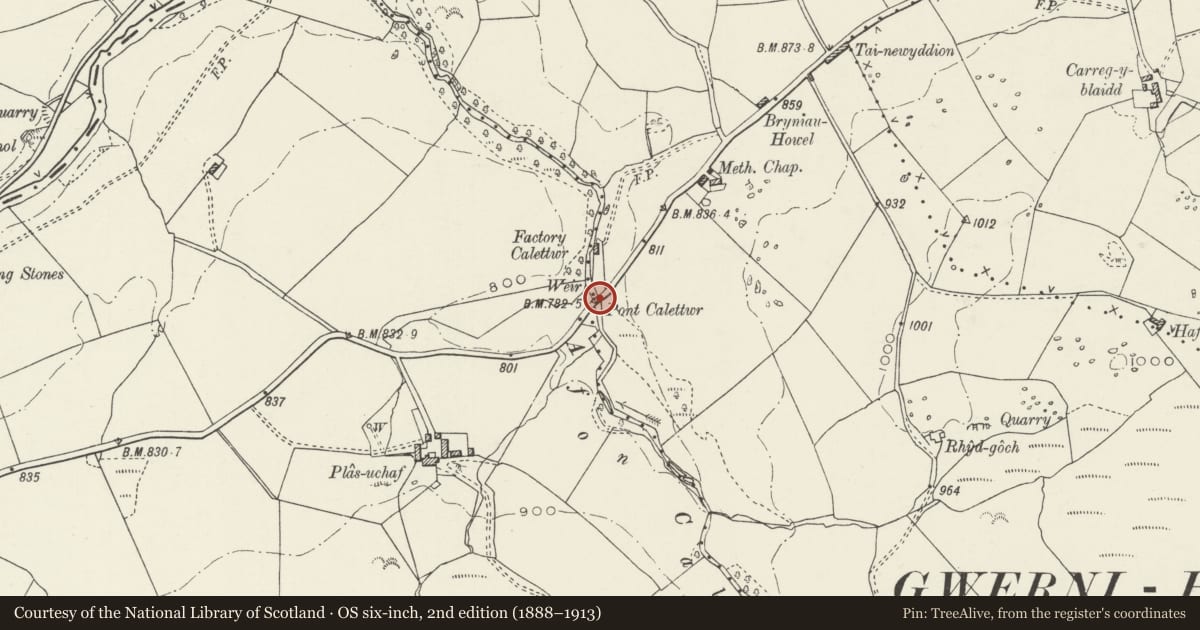
Slide toward Today to fade the historical sheet and see the modern map underneath.
David Rumsey Map Collection, Stanford LibrariesDavid Rumsey Map Collection, Stanford LibrariesLlyfrgell Genedlaethol Cymru – The National Library of WalesDavid Rumsey Map Collection, Stanford LibrariesDavid Rumsey Map Collection, Stanford Libraries
5 historical maps cover this location, the earliest the 1795 map "To Sir Watkin Williams-Wynn Bart ... the map of the six counties of North Wales is most humbly inscribed by his obedient humble servant" (Llyfrgell Genedlaethol Cymru – The National Library of Wales).
Historical maps covering this location
- 1795 · To Sir Watkin Williams-Wynn Bart ... the map of the six counties of North Wales is most… (Llyfrgell Genedlaethol Cymru – The National Library of Wales)
- 1830 · V.3:11-15:XV. Britisches Reich. A. Kon: England. b. Frstenthum Wales: Shire: 37-40 (David Rumsey Map Collection, Stanford Libraries)
- 1883 · Watershed map England, Wales 3. (David Rumsey Map Collection, Stanford Libraries)
- 1898 · 120 Corwen (Hills) (David Rumsey Map Collection, Stanford Libraries)
- 1901 · Sheet 9 and 10. (David Rumsey Map Collection, Stanford Libraries)
Cadw's description
Location
Spanning the Afon Caletwr at the north-eastern boundary of the community and carrying the road from Pentrefoelas to Ysbyty Ifan.
Exterior
Late C18 or early C19 single-span road bridge with earlier origins; overall length of some 15m. Rubble construction with wide segmental arch with rough-dressed voussoirs beneath and archring formed of narrow stones. The bridge has been doubled in width, the downstream side being the earliest. On this side irregular projecting masonry platforms testify to the presence of a predecessor; the bridge springs from rock foundations on the NE upstream side. Rubble parapets with old rough-dressed slab coping and splayed approaches; the carriageway is flat.
Reason for designation
Listed for its special historic interest as a late C18/early C19 vernacular road bridge.
Nearby in the register
- Plas Uchaf FarmhouseDomesticunder 1 mi
- Former House and adjoining Washhouse at Plas UchafDomesticunder 1 mi
- Church of St. JohnReligious, Ritual and Funeraryunder 1 mi
- Bryn ConwyDomesticunder 1 mi
Other entries of the same register within about three miles of this one, by straight line.