Cof Cymru: National Historic Assets of Wales · Wales
Ty'r Peg
Ysbyty Ifan, Conwy, Wales
A Grade II listed building in Hendre Isaf, Ysbyty Ifan, Conwy, designated on 8 April 1997.
The record
- Designation
- Listed building, Grade II
- Broad class
- Domestic
- Date of designation
- 8 April 1997
- Locality
- Hendre Isaf
- Community
- Ysbyty Ifan
- Unitary authority
- Conwy
- Country
- Wales
- Coordinates
- 53.04600, -3.71415
- Cadw reference
- 18328
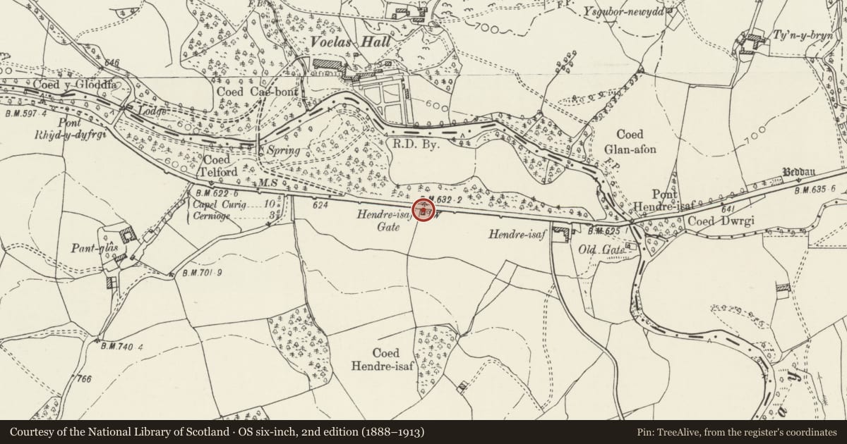
Slide toward Today to fade the historical sheet and see the modern map underneath.
David Rumsey Map Collection, Stanford LibrariesDavid Rumsey Map Collection, Stanford LibrariesLlyfrgell Genedlaethol Cymru – The National Library of WalesDavid Rumsey Map Collection, Stanford LibrariesDavid Rumsey Map Collection, Stanford Libraries
5 historical maps cover this location, the earliest the 1795 map "To Sir Watkin Williams-Wynn Bart ... the map of the six counties of North Wales is most humbly inscribed by his obedient humble servant" (Llyfrgell Genedlaethol Cymru – The National Library of Wales).
Historical maps covering this location
- 1795 · To Sir Watkin Williams-Wynn Bart ... the map of the six counties of North Wales is most… (Llyfrgell Genedlaethol Cymru – The National Library of Wales)
- 1830 · V.3:11-15:XV. Britisches Reich. A. Kon: England. b. Frstenthum Wales: Shire: 37-40 (David Rumsey Map Collection, Stanford Libraries)
- 1883 · Watershed map England, Wales 3. (David Rumsey Map Collection, Stanford Libraries)
- 1898 · 120 Corwen (Hills) (David Rumsey Map Collection, Stanford Libraries)
- 1901 · Sheet 9 and 10. (David Rumsey Map Collection, Stanford Libraries)
Cadw's description
Location
Prominently located on the roadside some 300m W of the junction of the A5 with the B 4407 to Ysbyty Ifan.
History
Early C19 toll house, constructed as one of a series on the new section of the famous London to Holyhead road, built c1815 by Thomas Telford, Engineer. Altered and extended late C19 by Lord Penrhyn of Penrhyn Castle for use as one of a number of keeper's cottages on the estate.
Exterior
Single-storey L-shaped lodge; of rubble construction with shallow-pitched slate roofs, half-hipped to the N and W. These have deep verges and eaves, the latter carried forward on the main (N) side to form a verandah-style porch over the entrance; plain wooden posts with struts. The entrance is to the L of a recessed 4-pane sash window and has a boarded door. To the L of this an advanced cross-wing with recessed 6-pane window to the road side and a blind window above, beneath the overhanging half-hipped roof. Plain 4-pane casement windows with slate lintels to the W and E sides, two to each; two entrances beyond on E, boarded and stable doors. Central stack with 2-stage chimney, rendered below and brown brick above, simply-moulded; weathercoursing.
Interior
The interior was not inspected at the time of resurvey (November 1996).
Reason for designation
Listed for its special historic interest as a prominently-sited and unusually well-preserved example of a toll house on Telford's important London to Holyhead road.
Nearby in the register
- Garden walls, terraces, potting shed and peach house at VoelasGardens, Parks and Urban Spacesunder 1 mi
- Hendre IsafDomesticunder 1 mi
- Carriage house at VoelasDomesticunder 1 mi
- Laundry, stable and bothy at VoelasDomesticunder 1 mi
Other entries of the same register within about three miles of this one, by straight line.