Cof Cymru: National Historic Assets of Wales · Wales
Ffronfelen
Llangybi, Ceredigion, Wales
A Grade II listed building in Silian, Lampeter, Llangybi, Ceredigion, designated on 24 February 1997.
The record
- Designation
- Listed building, Grade II
- Broad class
- Domestic
- Date of designation
- 24 February 1997
- Locality
- Silian
- Town
- Lampeter
- Community
- Llangybi
- Unitary authority
- Ceredigion
- Country
- Wales
- Coordinates
- 52.13728, -4.08899
- Cadw reference
- 18267
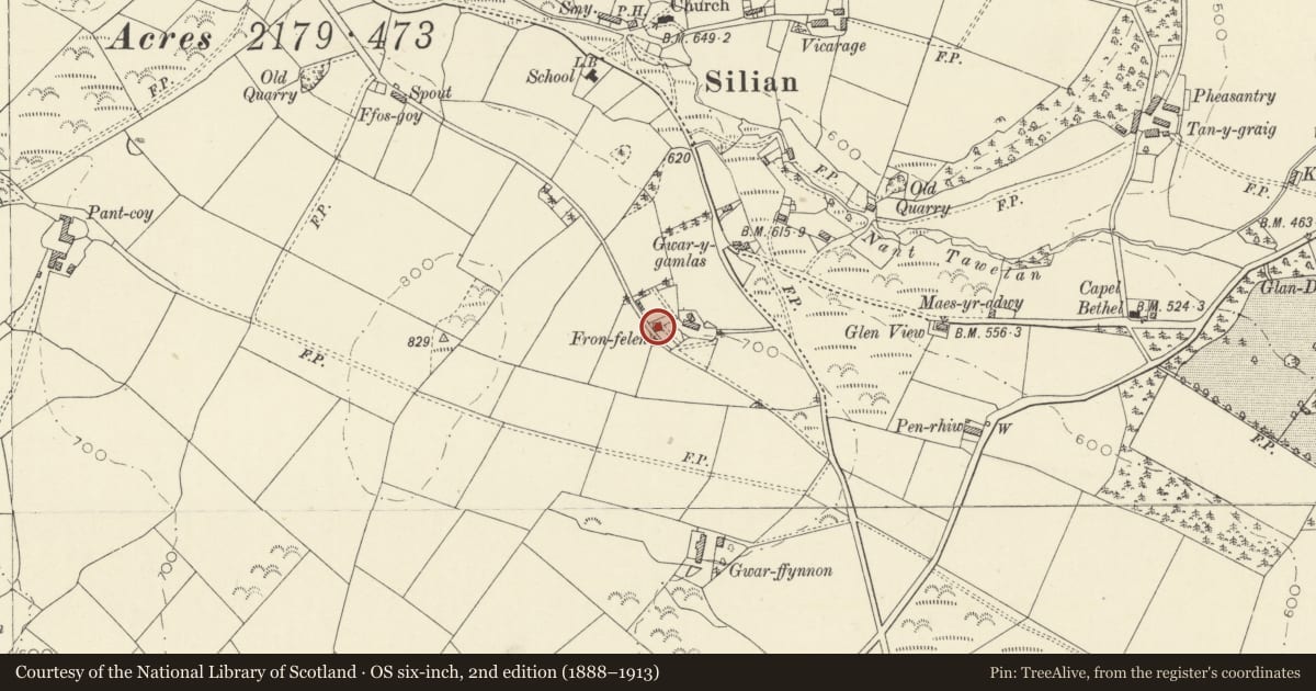
Slide toward Today to fade the historical sheet and see the modern map underneath.
David Rumsey Map Collection, Stanford LibrariesDavid Rumsey Map Collection, Stanford LibrariesDavid Rumsey Map Collection, Stanford LibrariesDavid Rumsey Map Collection, Stanford LibrariesDavid Rumsey Map Collection, Stanford Libraries
5 historical maps cover this location, the earliest the 1608 map "(13) Cambriae Typus." (David Rumsey Map Collection, Stanford Libraries).
Historical maps covering this location
- 1608 · (13) Cambriae Typus. (David Rumsey Map Collection, Stanford Libraries)
- 1830 · V.3:11-15:XV. Britisches Reich. A. Kon: England. b. Frstenthum Wales: Shire: 37-40 (David Rumsey Map Collection, Stanford Libraries)
- 1899 · 195 Lampeter (Hills) (David Rumsey Map Collection, Stanford Libraries)
- 1901 · Sheet 14. (David Rumsey Map Collection, Stanford Libraries)
- 1919 · Sheet 78. Lampeter. (David Rumsey Map Collection, Stanford Libraries)
Cadw's description
Location
Situated on E facing hillside, reached from minor lane that has junction with road from Silian to A485, some 300m SSE of Silian church.
History
Minor gentry house of c1840, said to have deeds from 1838. A house is marked on 1846 Silian Tithe Map, owned by Evan Morgan, occupied by David Lewes, but appears to be below present house site.
Exterior
Whitewashed rubble stone with slate hipped roof, and whitewashed stone end stacks. Two-storey, three-window front range, with raised plinth and flat eaves. Hornless 12-pane sashes with stone voussoirs. Centre 6-panel door with overlight, slate steps up with iron railings. External shutters to ground floor windows. Gabled rear centre, slate-hung with one 6-pane window. 12-pane sash each floor each side. Single storey outbuilding attached to N end wall.
Reason for designation
Listed as a well-preserved late Georgian style small country house, rare in this part of Cardiganshire.
Nearby in the register
- Sculptured Stone in ChurchDecorated stoneunder 1 mi
- Bethel Baptist ChapelReligious, Ritual and Funeraryunder 1 mi
- Railings surrounding tomb of J. Evans, Tanygraig at Capel Bethel.Religious, Ritual and Funeraryunder 1 mi
- North LodgeDomesticunder 1 mi
Other entries of the same register within about three miles of this one, by straight line.