Cof Cymru: National Historic Assets of Wales · Wales
Railings surrounding tomb of J. Evans, Tanygraig at Capel Bethel.
Llangybi, Ceredigion, Wales
A Grade II listed building in Silian, Lampeter, Llangybi, Ceredigion, designated on 24 February 1997.
The record
- Designation
- Listed building, Grade II
- Broad class
- Religious, Ritual and Funerary
- Date of designation
- 24 February 1997
- Locality
- Silian
- Town
- Lampeter
- Community
- Llangybi
- Unitary authority
- Ceredigion
- Country
- Wales
- Coordinates
- 52.13756, -4.07954
- Cadw reference
- 18266
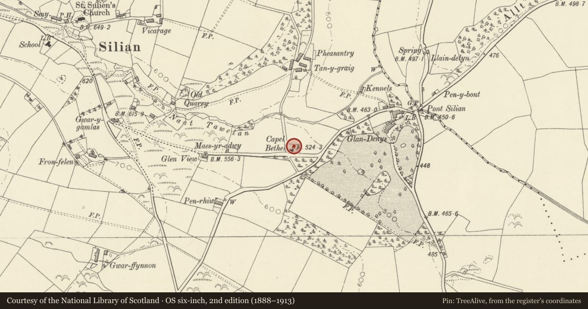
Slide toward Today to fade the historical sheet and see the modern map underneath.
David Rumsey Map Collection, Stanford LibrariesDavid Rumsey Map Collection, Stanford LibrariesDavid Rumsey Map Collection, Stanford LibrariesDavid Rumsey Map Collection, Stanford LibrariesDavid Rumsey Map Collection, Stanford Libraries
5 historical maps cover this location, the earliest the 1608 map "(13) Cambriae Typus." (David Rumsey Map Collection, Stanford Libraries).
Historical maps covering this location
- 1608 · (13) Cambriae Typus. (David Rumsey Map Collection, Stanford Libraries)
- 1830 · V.3:11-15:XV. Britisches Reich. A. Kon: England. b. Frstenthum Wales: Shire: 37-40 (David Rumsey Map Collection, Stanford Libraries)
- 1899 · 195 Lampeter (Hills) (David Rumsey Map Collection, Stanford Libraries)
- 1901 · Sheet 14. (David Rumsey Map Collection, Stanford Libraries)
- 1919 · Sheet 78. Lampeter. (David Rumsey Map Collection, Stanford Libraries)
Cadw's description
Location
Situated in graveyard to rear of Bethel Baptist Chapel.
History
Railed enclosure of typical South Cardiganshire scrolled work around tomb of John Evans, Tanygraig, (d1843), donor of land on which Bethel Chapel was built in 1839.
Exterior
Slate table tomb to John Evans, Tanygraig, (d 1843) with moulded angle columns and inset raised plaques. Ornate large iron-railings to large enclosure with spearhead rails scrolled below top-rail and scrolled tops to corner and 2 intermediate stanchions each side. S side has entrance arch with eroded scrolls and tall top finial much decorated with scrolls. Damaged iron gate with similar spearhead rails. Centre of N side has a similar tall finial.
Reason for designation
Listed for the exceptional ironwork special to South Cardiganshire grave enclosures and notable for the display of scroll-work.
Nearby in the register
- Bethel Baptist ChapelReligious, Ritual and Funeraryunder 1 mi
- FfronfelenDomesticunder 1 mi
- Sculptured Stone in ChurchDecorated stoneunder 1 mi
- Gaer Coed Parc Hillfort and EnclosureHillfortunder 1 mi
Other entries of the same register within about three miles of this one, by straight line.