Cof Cymru: National Historic Assets of Wales · Wales
Althrey Woodhouse Barn
Bangor is-y-Coed, Wrexham, Wales
A Grade II listed building in Althrey, Bangor is-y-Coed, Wrexham, designated on 24 February 1997.
The record
- Designation
- Listed building, Grade II
- Broad class
- Agriculture and Subsistence
- Date of designation
- 24 February 1997
- Locality
- Althrey
- Community
- Bangor is-y-Coed
- Unitary authority
- Wrexham
- Country
- Wales
- Coordinates
- 52.98944, -2.92107
- Cadw reference
- 18260
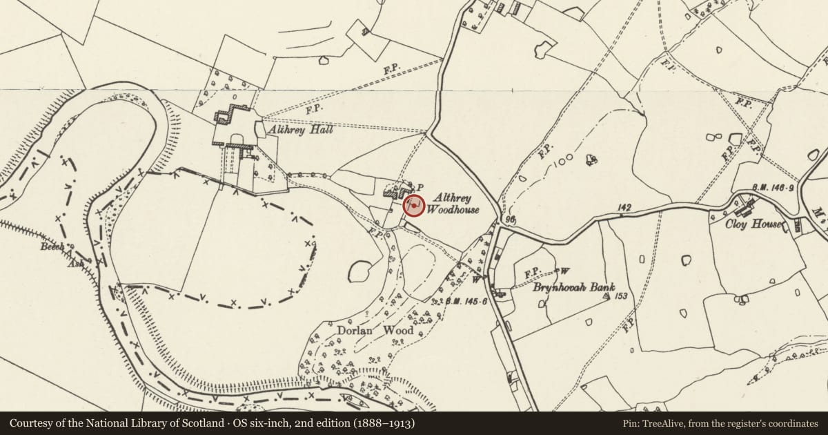
Slide toward Today to fade the historical sheet and see the modern map underneath.
David Rumsey Map Collection, Stanford LibrariesDavid Rumsey Map Collection, Stanford LibrariesDavid Rumsey Map Collection, Stanford LibrariesDavid Rumsey Map Collection, Stanford LibrariesDavid Rumsey Map Collection, Stanford Libraries
5 historical maps cover this location, the earliest the 1608 map "(13) Cambriae Typus." (David Rumsey Map Collection, Stanford Libraries).
Historical maps covering this location
- 1608 · (13) Cambriae Typus. (David Rumsey Map Collection, Stanford Libraries)
- 1637 · Particular description of Wales. Cambria seu Wallia (David Rumsey Map Collection, Stanford Libraries)
- 1830 · V.3:11-15:XV.Britisches Reich. A. Kon: England. a. England ab sich: Shire:15-17, 33 (David Rumsey Map Collection, Stanford Libraries)
- 1883 · Watershed map England, Wales 3. (David Rumsey Map Collection, Stanford Libraries)
- 1901 · Sheet 9 and 10. (David Rumsey Map Collection, Stanford Libraries)
Cadw's description
Location
Situated immediately to the E of Althrey Woodhouse Farmhouse, reached from a subsidiary drive leading W from the B5069.
History
Probably erected C17, the brick nogging is possibly secondary. Roof covering and false ceiling of later C20 date.
Exterior
Timber framing with brick nogging, sheeted metal roof, brick plinth W side. Large barn framed in rectangular panels many of which have slender secondary rails; off-centre opposed opening and to the S end a secondary set of opposed openings, that to the W side blocked. The N gable end elevation has a truss with diagonal struts and diagonal braces at eaves level.
Interior
Some tie-beam trusses with diagonal struts are visible above the false ceiling. Full inspection of the roof structure not possible at the time of the 1996 survey, but it seems that most or all original trusses and some purlins survive though the original ridge is missing.
Reason for designation
Listed as a good relatively well-preserved example of a C17 timber-frame barn.
Nearby in the register
- Althrey HallDomesticunder 1 mi
- Brynhovah CottageDomesticunder 1 mi
- Hole in the WallDomesticunder 1 mi
- Argoed FarmhouseDomesticunder 1 mi
Other entries of the same register within about three miles of this one, by straight line.