Cof Cymru: National Historic Assets of Wales · Wales
Graig Cottage
Bangor is-y-Coed, Wrexham, Wales
A Grade II listed building in Bangor Is-y-coed, Wrexham, designated on 24 February 1997.
The record
- Designation
- Listed building, Grade II
- Broad class
- Domestic
- Date of designation
- 24 February 1997
- Locality
- Bangor Is-y-coed
- Community
- Bangor is-y-Coed
- Unitary authority
- Wrexham
- Country
- Wales
- Coordinates
- 53.00579, -2.90271
- Cadw reference
- 18259
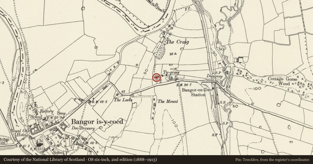
Slide toward Today to fade the historical sheet and see the modern map underneath.
David Rumsey Map Collection, Stanford LibrariesDavid Rumsey Map Collection, Stanford LibrariesDavid Rumsey Map Collection, Stanford LibrariesDavid Rumsey Map Collection, Stanford LibrariesDavid Rumsey Map Collection, Stanford Libraries
5 historical maps cover this location, the earliest the 1608 map "(13) Cambriae Typus." (David Rumsey Map Collection, Stanford Libraries).
Historical maps covering this location
- 1608 · (13) Cambriae Typus. (David Rumsey Map Collection, Stanford Libraries)
- 1861 · 73. Market Drayton. (David Rumsey Map Collection, Stanford Libraries)
- 1883 · Watershed map England, Wales 3. (David Rumsey Map Collection, Stanford Libraries)
- 1897 · 122 Nantwich (Hills) (David Rumsey Map Collection, Stanford Libraries)
- 1901 · Sheet 9 and 10. (David Rumsey Map Collection, Stanford Libraries)
Cadw's description
Location
Set back from Station Road at the outskirts of the village.
History
Probably built late C18, some C20 alterations. Unoccupied at time of 1996 survey.
Exterior
Brick in English garden wall bond, hipped slate roof with red ridge tiles, rendered end wall stacks. Two-storey, 2-window symmetrical elevation to road with dentil eaves course, central C20 door and trellised porch flanked by multipaned windows with cambered heads. Smaller multipaned casement windows to upper floor.
Interior
Not accessible at time of 1996 survey.
Reason for designation
Listed as a good relatively unaltered example of a building type which rarely survives in this form.
Nearby in the register
- The StableyardCommercialunder 1 mi
- Old Bridge HouseDomesticunder 1 mi
- Church of St. DunawdReligious, Ritual and Funeraryunder 1 mi
- War MemorialCommemorativeunder 1 mi
Other entries of the same register within about three miles of this one, by straight line.