Cof Cymru: National Historic Assets of Wales · Wales
Farm building at Lower Glyn farm
Manafon, Powys, Wales
A Grade II listed building in Manafon-gaenog, Manafon, Powys, designated on 4 February 1997.
The record
- Designation
- Listed building, Grade II
- Broad class
- Agriculture and Subsistence
- Date of designation
- 4 February 1997
- Locality
- Manafon-gaenog
- Town
- Manafon
- Community
- Manafon
- Unitary authority
- Powys
- Country
- Wales
- Coordinates
- 52.62151, -3.28521
- Cadw reference
- 18225
Slide toward Today to fade the historical sheet and see the modern map underneath.
David Rumsey Map Collection, Stanford LibrariesDavid Rumsey Map Collection, Stanford LibrariesDavid Rumsey Map Collection, Stanford LibrariesDavid Rumsey Map Collection, Stanford LibrariesLlyfrgell Genedlaethol Cymru – The National Library of Wales
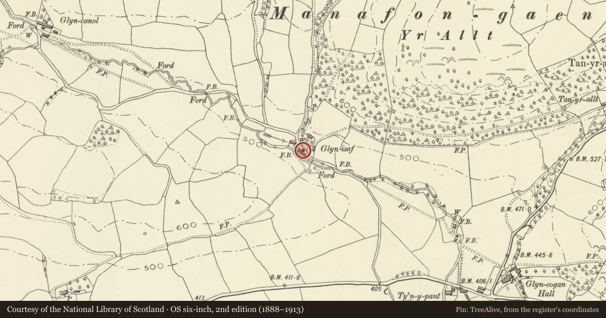
5 historical maps cover this location, the earliest the 1795 map "To Sir Watkin Williams-Wynn Bart ... the map of the six counties of North Wales is most humbly inscribed by his obedient humble servant" (Llyfrgell Genedlaethol Cymru – The National Library of Wales).
Historical maps covering this location
- 1795 · To Sir Watkin Williams-Wynn Bart ... the map of the six counties of North Wales is most… (Llyfrgell Genedlaethol Cymru – The National Library of Wales)
- 1883 · Watershed map England, Wales 3. (David Rumsey Map Collection, Stanford Libraries)
- 1899 · 151 Welshpool (Hills) (David Rumsey Map Collection, Stanford Libraries)
- 1901 · Sheet 9 and 10. (David Rumsey Map Collection, Stanford Libraries)
- 1916 · Sheet 60. Shrewsbury. (David Rumsey Map Collection, Stanford Libraries)
Cadw's description
Location
The barn is set apart from the other farm buildings, alongside the road, and below the farmhouse, at Lower Glyn.
History
A cruck built barn, probably of the mid-later C16.
Exterior
The building is of 5 bays, with weatherboarded clad framed walling and a corrugated iron roof. Five doors, on the left stable doors to the cow housing with feeding walk door between, a door to the drying bay at the centre, a high-set door to the grain store in the 4th bay from the SE end, and stable door to the end bay. One raking dormer to the tallet over the cowhouse.
Interior
Built of 4 well formed cruck couples, with tie beam, collar and yoke apex, some with queen struts, and the blades set on sill plates. Truss 3 is a compound variant, probably due to later alterations. Two tiers of purlins, and outrider timbers to wall plates. Erection took place from each end towards the middle.
Reason for designation
Included as a good example of cruck construction of high quality.
Nearby in the register
- Dol-terfynDomesticunder 1 mi
- Glyn ganolDomesticunder 1 mi
- Hen llysDomesticunder 1 mi
- Bron-y-rhiw CottageDomestic1 mi
Other entries of the same register within about three miles of this one, by straight line.