Cof Cymru: National Historic Assets of Wales · Wales
Bron-y-rhiw Cottage
Manafon, Powys, Wales
A Grade II listed building in Manafon, Powys, designated on 4 February 1997.
The record
- Designation
- Listed building, Grade II
- Broad class
- Domestic
- Date of designation
- 4 February 1997
- Locality
- Manafon
- Town
- Manafon
- Community
- Manafon
- Unitary authority
- Powys
- Country
- Wales
- Coordinates
- 52.61286, -3.30536
- Cadw reference
- 18228
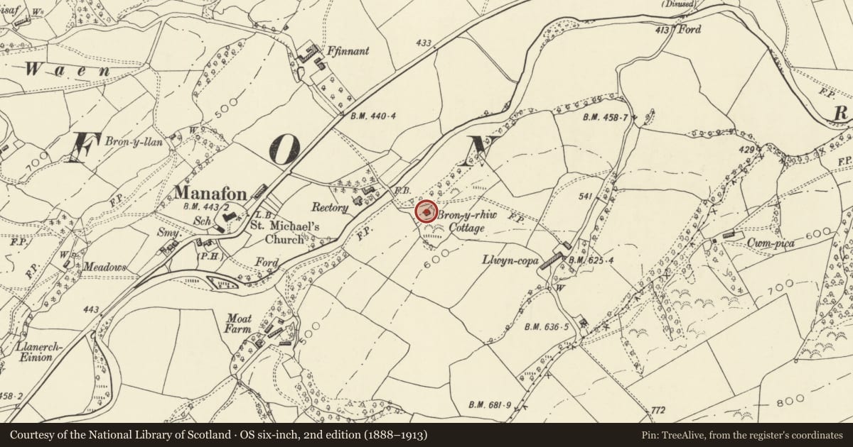
Slide toward Today to fade the historical sheet and see the modern map underneath.
David Rumsey Map Collection, Stanford LibrariesDavid Rumsey Map Collection, Stanford LibrariesDavid Rumsey Map Collection, Stanford LibrariesDavid Rumsey Map Collection, Stanford LibrariesLlyfrgell Genedlaethol Cymru – The National Library of Wales
5 historical maps cover this location, the earliest the 1795 map "To Sir Watkin Williams-Wynn Bart ... the map of the six counties of North Wales is most humbly inscribed by his obedient humble servant" (Llyfrgell Genedlaethol Cymru – The National Library of Wales).
Historical maps covering this location
- 1795 · To Sir Watkin Williams-Wynn Bart ... the map of the six counties of North Wales is most… (Llyfrgell Genedlaethol Cymru – The National Library of Wales)
- 1883 · Watershed map England, Wales 3. (David Rumsey Map Collection, Stanford Libraries)
- 1899 · 151 Welshpool (Hills) (David Rumsey Map Collection, Stanford Libraries)
- 1901 · Sheet 9 and 10. (David Rumsey Map Collection, Stanford Libraries)
- 1916 · Sheet 60. Shrewsbury. (David Rumsey Map Collection, Stanford Libraries)
Cadw's description
Location
Located above the S bank of the Afon Rhiw, at the end of the small lane leading S off the main Berriew to Llanfair Caereinion road, leading past the Old Rectory.
History
Said to have been originally built in 1802 by the rector (then Morgan Davies) for the village schoolmaster.
Exterior
Roughcast with a slate roof. Two storeys, 3 bays. Symmetrical about the central door, set within a later lean-to porch. To either side, late C19 3-light timber cross windows with lead paned glazing, with painted wedge lintels. Over the door, a narrower blind window recess painted with glazing bars. Pyramidal roof and central stack. Lean-to at right end.
Interior
Not accessible at the time of inspection (Sept 1996).
Reason for designation
Included as a well designed house in a Regency idiom, the symmetry respected by later inserted windows.
Nearby in the register
- The Grange, also known as The Old RectoryReligious, Ritual and Funeraryunder 1 mi
- Church of St Michael and All AngelsReligious, Ritual and Funeraryunder 1 mi
- Lych gate to the churchyard, Church of St Michael and All Angels.Religious, Ritual and Funeraryunder 1 mi
- The SmithyDomesticunder 1 mi
Other entries of the same register within about three miles of this one, by straight line.