Cof Cymru: National Historic Assets of Wales · Wales
Hafod y Llan, also known as the Old Rectory
Llanbrynmair, Powys, Wales
A Grade II listed building in Llan, Llanbrynmair, Powys, designated on 31 January 1997.
The record
- Designation
- Listed building, Grade II
- Broad class
- Domestic
- Date of designation
- 31 January 1997
- Locality
- Llan
- Community
- Llanbrynmair
- Unitary authority
- Powys
- Country
- Wales
- Coordinates
- 52.59368, -3.64895
- Cadw reference
- 18134
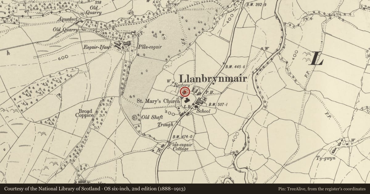
Slide toward Today to fade the historical sheet and see the modern map underneath.
David Rumsey Map Collection, Stanford LibrariesDavid Rumsey Map Collection, Stanford LibrariesDavid Rumsey Map Collection, Stanford LibrariesLlyfrgell Genedlaethol Cymru – The National Library of WalesDavid Rumsey Map Collection, Stanford Libraries
5 historical maps cover this location, the earliest the 1795 map "To Sir Watkin Williams-Wynn Bart ... the map of the six counties of North Wales is most humbly inscribed by his obedient humble servant" (Llyfrgell Genedlaethol Cymru – The National Library of Wales).
Historical maps covering this location
- 1795 · To Sir Watkin Williams-Wynn Bart ... the map of the six counties of North Wales is most… (Llyfrgell Genedlaethol Cymru – The National Library of Wales)
- 1830 · V.3:11-15:XV. Britisches Reich. A. Kon: England. b. Frstenthum Wales: Shire: 37-40 (David Rumsey Map Collection, Stanford Libraries)
- 1883 · Watershed map England, Wales 3. (David Rumsey Map Collection, Stanford Libraries)
- 1899 · 150 Dinas-Mawddwy (Hills) (David Rumsey Map Collection, Stanford Libraries)
- 1901 · Sheet 9 and 10. (David Rumsey Map Collection, Stanford Libraries)
Cadw's description
Location
Located close to the NW side of the graveyard of the church of St Mary, and approached by a driveway under the churchyard wall.
Exterior
Painted stone, with asbestos slate roof. Two storeys, originally a small 2-bay house comprising a hall with gable stack, and inner rooms, later extended to the E by 2 window bays, probably in 1841, and by a major extension to the rear forming a 3-storey range. Gabled porch with turned balusters on stone wing walls, with a datestone over reading 'Laus Deo I.G.K. MDCCCXLIII' (Rector I.G.Kirkham). Two and 3-light cast iron lattice windows to 2 floors facing the church. Very large stone stack originally at gable end, with stepped weatherings, raised in the late C19 in brick. External stone steps to attic at left end. Rear not seen.
Reason for designation
Included as an interesting and picturesque house of group value with the church.
Nearby in the register
- Church of St MaryReligious, Ritual and Funeraryunder 1 mi
- Sundial in the Churchyard of the Church of St MaryReligious, Ritual and Funeraryunder 1 mi
- Plas esgairDomesticunder 1 mi
- Bethel Chapel and Forecourt RailingsReligious, Ritual and Funeraryunder 1 mi
Other entries of the same register within about three miles of this one, by straight line.