Cof Cymru: National Historic Assets of Wales · Wales
Bethel Chapel and Forecourt Railings
Llanbrynmair, Powys, Wales
A Grade II listed building in Bont Dolgadfan, Llanbrynmair, Powys, designated on 31 January 1997.
The record
- Designation
- Listed building, Grade II
- Broad class
- Religious, Ritual and Funerary
- Date of designation
- 31 January 1997
- Locality
- Bont Dolgadfan
- Community
- Llanbrynmair
- Unitary authority
- Powys
- Country
- Wales
- Coordinates
- 52.58857, -3.64665
- Cadw reference
- 18127
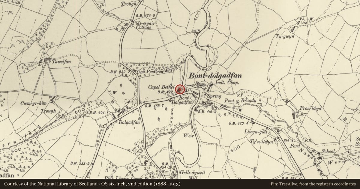
Slide toward Today to fade the historical sheet and see the modern map underneath.
David Rumsey Map Collection, Stanford LibrariesDavid Rumsey Map Collection, Stanford LibrariesLlyfrgell Genedlaethol Cymru – The National Library of WalesDavid Rumsey Map Collection, Stanford LibrariesDavid Rumsey Map Collection, Stanford Libraries
5 historical maps cover this location, the earliest the 1608 map "(13) Cambriae Typus." (David Rumsey Map Collection, Stanford Libraries).
Historical maps covering this location
- 1608 · (13) Cambriae Typus. (David Rumsey Map Collection, Stanford Libraries)
- 1795 · To Sir Watkin Williams-Wynn Bart ... the map of the six counties of North Wales is most… (Llyfrgell Genedlaethol Cymru – The National Library of Wales)
- 1830 · V.3:11-15:XV. Britisches Reich. A. Kon: England. b. Frstenthum Wales: Shire: 37-40 (David Rumsey Map Collection, Stanford Libraries)
- 1883 · Watershed map England, Wales 3. (David Rumsey Map Collection, Stanford Libraries)
- 1901 · Sheet 9 and 10. (David Rumsey Map Collection, Stanford Libraries)
Cadw's description
Location
The chapel is located at an angle to the road, at the entrance to Bont Dolgadfan village from the B 4518, behind the house Tan-y-capel. The schoolroom and meeting room are attached by a lean-to roof to the rear of the chapel, closest to the road.
History
Chapel of the Calvinistic Methodist meeting, first built in 1767, and rebuilt in 1820. It was entirely renewed in 1895, to which date the interior fittings belong.
Exterior
A large building with the entrance facade facing N away from the road. Rock faced snecked stone with old slate roof. Entrance front symmetrical, with a central pair of doors with fanlight in a shallow gabled porch. Two storeys of 8-paned sashes, with limestone heads and sills to openings, the upper windows round headed, the lower segmental, both keyed. Large central tablet giving the date of constructions. One painted zinc pyramidal roof vent set centrally to ridge. To the rear a single storey vestry and 3-bay schoolroom with hipped roof and 8-paned sashes, canted at the corner.
The forecourt is paved with blue stable bricks and has cast iron railings of 1896 by J.D.Davies of Machynlleth mounted on a low slate coped wall.
Interior
Raked gallery around two sides with a panelled and balustraded front, all supported on fluted Composite columns. Panelled pulpit with classical panelled Ionic reredos and a half-round fan head. Numbered pews. White marble wall tablets to William Howell and wife, d.1854 and 1862.
Reason for designation
Included as a well preserved chapel displaying the assurance and comparative wealth of the local Calvinistic Methodist community at the end of the C19.
Nearby in the register
- Bont DolgadfanTransportunder 1 mi
- GlantwymynDomesticunder 1 mi
- TremafonDomesticunder 1 mi
- BrynawelDomesticunder 1 mi
Other entries of the same register within about three miles of this one, by straight line.