Cof Cymru: National Historic Assets of Wales · Wales
Coed Cae
Llanbrynmair, Powys, Wales
A Grade II listed building in Llanbrynmair, Powys, designated on 31 January 1997.
The record
- Designation
- Listed building, Grade II
- Broad class
- Domestic
- Date of designation
- 31 January 1997
- Locality
- Llanbrynmair
- Community
- Llanbrynmair
- Unitary authority
- Powys
- Country
- Wales
- Coordinates
- 52.61056, -3.61963
- Cadw reference
- 18115
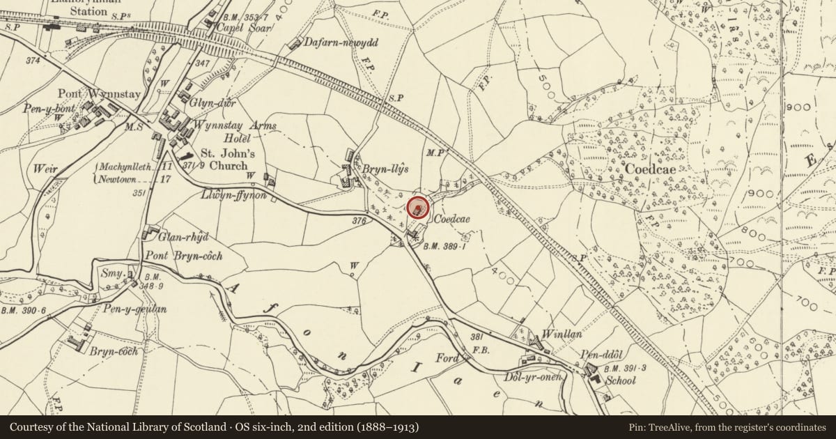
Slide toward Today to fade the historical sheet and see the modern map underneath.
David Rumsey Map Collection, Stanford LibrariesDavid Rumsey Map Collection, Stanford LibrariesDavid Rumsey Map Collection, Stanford LibrariesLlyfrgell Genedlaethol Cymru – The National Library of WalesDavid Rumsey Map Collection, Stanford Libraries
5 historical maps cover this location, the earliest the 1608 map "(13) Cambriae Typus." (David Rumsey Map Collection, Stanford Libraries).
Historical maps covering this location
- 1608 · (13) Cambriae Typus. (David Rumsey Map Collection, Stanford Libraries)
- 1795 · To Sir Watkin Williams-Wynn Bart ... the map of the six counties of North Wales is most… (Llyfrgell Genedlaethol Cymru – The National Library of Wales)
- 1883 · Watershed map England, Wales 3. (David Rumsey Map Collection, Stanford Libraries)
- 1899 · 150 Dinas-Mawddwy (Hills) (David Rumsey Map Collection, Stanford Libraries)
- 1901 · Sheet 9 and 10. (David Rumsey Map Collection, Stanford Libraries)
Cadw's description
Location
The farmhouse is located approximately 600m S of the centre of the village, and is set with its left gable to the road. The farm buildings lie to the N.
History
The present building appears to date from the early C19, perhaps related to increased prosperity in the locality following the turnpiking of the Caersws to Machynlleth road in 1821.
Exterior
Rubble stonework with slate roof. Two storeys and a cellar under the NE bay, and a lower 2-storey rear service wing to the left bay, with a gable stack. The main block is of 3 bays, with a central 4-panelled door, the upper panels glazed, and plain overlight, and 16-paned sash windows with heavy stone lintels. Large gable end stacks with weather stones stepping over the roof. Timber extension on rear wing.
Reason for designation
Included as a well preserved example of an early C19 farmhouse of the Iaen Valley, which retains much of its original character and fabric.
Nearby in the register
- Bryn llysDomesticunder 1 mi
- Wynnstay ArmsCommercialunder 1 mi
- Milestone at Llanbrynmair BridgeTransportunder 1 mi
- Llanbrynmair Railway Station and houseTransportunder 1 mi
Other entries of the same register within about three miles of this one, by straight line.