Cof Cymru: National Historic Assets of Wales · Wales
Former oil store at Caldey Lighthouse
Tenby, Pembrokeshire, Wales
A Grade II listed building in Caldey Lighthouse, Tenby, Pembrokeshire, designated on 29 March 1996.
The record
- Designation
- Listed building, Grade II
- Broad class
- Maritime
- Date of designation
- 29 March 1996
- Locality
- Caldey Lighthouse
- Town
- Tenby
- Community
- Tenby
- Unitary authority
- Pembrokeshire
- Country
- Wales
- Coordinates
- 51.63168, -4.68484
- Cadw reference
- 18025
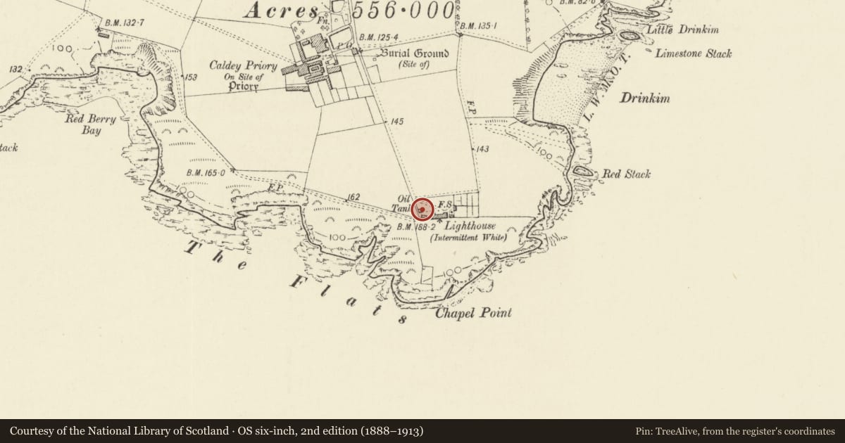
Slide toward Today to fade the historical sheet and see the modern map underneath.
David Rumsey Map Collection, Stanford LibrariesDavid Rumsey Map Collection, Stanford LibrariesDavid Rumsey Map Collection, Stanford LibrariesDavid Rumsey Map Collection, Stanford LibrariesDavid Rumsey Map Collection, Stanford Libraries
5 historical maps cover this location, the earliest the 1636 map "Cornubia : Devonia, Somersetus, Dorcestria, Wiltonia, Glocestria ..." (David Rumsey Map Collection, Stanford Libraries).
Historical maps covering this location
- 1636 · Cornubia : Devonia, Somersetus, Dorcestria, Wiltonia, Glocestria ... (David Rumsey Map Collection, Stanford Libraries)
- 1637 · The fourth table of England. Cornub. Devonia, Somerset etc. (David Rumsey Map Collection, Stanford Libraries)
- 1865 · England and Wales. England No. 6. (David Rumsey Map Collection, Stanford Libraries)
- 1891 · Sheet 10. Ordnance Survey of England and Wales. . (David Rumsey Map Collection, Stanford Libraries)
- 1898 · 245 Pembroke (Hills) (David Rumsey Map Collection, Stanford Libraries)
Cadw's description
Location
Towards the SW of the lighthouse compound.
History
Lighthouse oil-store, dated 1875, built to a standard Trinity House design.
Exterior
Oil-store, unpainted render over rubble stone and brick with grouted slate roof. Moulded kneelers to coped gables, rounded course under eaves. Single-storey with S end entry, quoins, tall doorway with hoodmould, double doors and blocked overlight. Date 1875 in raised letters above, under roundel vent with hoodmould. Lunette and roundel in S gable.
Render has fallen away on S end showing brickwork around doorway, stone in gable.
Reason for designation
Included as an element in the coherent group of structures associated with Caldey Lighthouse, and an integral part of the former working arrangements of it.
Nearby in the register
- Outbuilding to W of lighthouseHealth and Welfareunder 1 mi
- Boundary walls to lighthouse compoundMaritimeunder 1 mi
- Lighthouse with adjoining former Keepers' CottagesMaritimeunder 1 mi
- Outbuilding E of the lighthouseHealth and Welfareunder 1 mi
Other entries of the same register within about three miles of this one, by straight line.