Cof Cymru: National Historic Assets of Wales · Wales
Game Larder
Stackpole and Castlemartin, Pembrokeshire, Wales
A Grade II listed building in Stackpole Court, Stackpole and Castlemartin, Pembrokeshire, designated on 8 February 1996.
The record
- Designation
- Listed building, Grade II
- Broad class
- Agriculture and Subsistence
- Date of designation
- 8 February 1996
- Locality
- Stackpole Court
- Community
- Stackpole and Castlemartin
- Unitary authority
- Pembrokeshire
- Country
- Wales
- Coordinates
- 51.62740, -4.92422
- Cadw reference
- 17995
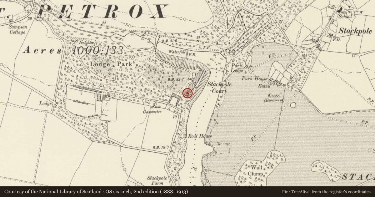
Slide toward Today to fade the historical sheet and see the modern map underneath.
David Rumsey Map Collection, Stanford LibrariesDavid Rumsey Map Collection, Stanford LibrariesDavid Rumsey Map Collection, Stanford LibrariesDavid Rumsey Map Collection, Stanford LibrariesDavid Rumsey Map Collection, Stanford Libraries
5 historical maps cover this location, the earliest the 1636 map "Cornubia : Devonia, Somersetus, Dorcestria, Wiltonia, Glocestria ..." (David Rumsey Map Collection, Stanford Libraries).
Historical maps covering this location
- 1636 · Cornubia : Devonia, Somersetus, Dorcestria, Wiltonia, Glocestria ... (David Rumsey Map Collection, Stanford Libraries)
- 1637 · The fourth table of England. Cornub. Devonia, Somerset etc. (David Rumsey Map Collection, Stanford Libraries)
- 1865 · England and Wales. England No. 6. (David Rumsey Map Collection, Stanford Libraries)
- 1891 · Sheet 10. Ordnance Survey of England and Wales. . (David Rumsey Map Collection, Stanford Libraries)
- 1898 · 245 Pembroke (Hills) (David Rumsey Map Collection, Stanford Libraries)
Cadw's description
Exterior
At S of the site of Stackpole Court, adjacent to the Brewery.
The Game larder predates the adjacent Brewery of 1843.
Single room 5.4 m by 3.6 m, in rendered rubble masonry with a hipped slate roof carried on two trusses. One entrance door, at N. Windows and ventilators at E and W. Below the trusses are suspended two beams with rows of hooks for game hanging. Later hanging frame at lower level with 8 similar beams. Slate floor and slate window sills. Original window design not apparent.
The building is now used as a National Trust information point.
A complete specimen of its type. Listed also for group value with the other survivals of the Stackpole Court buildings.
Reference: NT (Stackpole) information.
Nearby in the register
- BreweryIndustrialunder 1 mi
- Dairymaid's QuartersAgriculture and Subsistenceunder 1 mi
- Gateway to Brewery YardIndustrialunder 1 mi
- Courtyard FlatsDomesticunder 1 mi
Other entries of the same register within about three miles of this one, by straight line.