Cof Cymru: National Historic Assets of Wales · Wales
Dairymaid's Quarters
Stackpole and Castlemartin, Pembrokeshire, Wales
A Grade II listed building in Stackpole Court, Stackpole and Castlemartin, Pembrokeshire, designated on 8 February 1996.
The record
- Designation
- Listed building, Grade II
- Broad class
- Agriculture and Subsistence
- Date of designation
- 8 February 1996
- Locality
- Stackpole Court
- Community
- Stackpole and Castlemartin
- Unitary authority
- Pembrokeshire
- Country
- Wales
- Coordinates
- 51.62735, -4.92431
- Cadw reference
- 17991
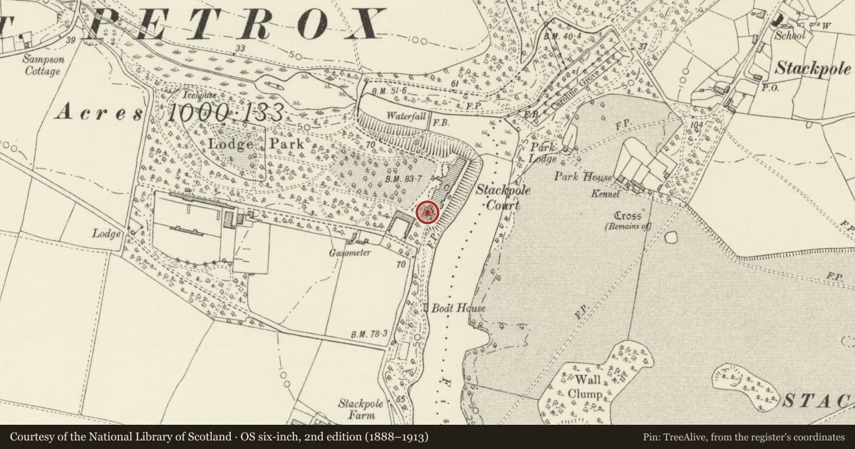
Slide toward Today to fade the historical sheet and see the modern map underneath.
David Rumsey Map Collection, Stanford LibrariesDavid Rumsey Map Collection, Stanford LibrariesDavid Rumsey Map Collection, Stanford LibrariesDavid Rumsey Map Collection, Stanford LibrariesDavid Rumsey Map Collection, Stanford Libraries
5 historical maps cover this location, the earliest the 1636 map "Cornubia : Devonia, Somersetus, Dorcestria, Wiltonia, Glocestria ..." (David Rumsey Map Collection, Stanford Libraries).
Historical maps covering this location
- 1636 · Cornubia : Devonia, Somersetus, Dorcestria, Wiltonia, Glocestria ... (David Rumsey Map Collection, Stanford Libraries)
- 1637 · The fourth table of England. Cornub. Devonia, Somerset etc. (David Rumsey Map Collection, Stanford Libraries)
- 1865 · England and Wales. England No. 6. (David Rumsey Map Collection, Stanford Libraries)
- 1891 · Sheet 10. Ordnance Survey of England and Wales. . (David Rumsey Map Collection, Stanford Libraries)
- 1898 · 245 Pembroke (Hills) (David Rumsey Map Collection, Stanford Libraries)
Cadw's description
Exterior
At S end of the site of Stackpole Court, at S of the brewery group. Also called Cawdor cottage.
Designed by Henry Ashton, architect, in 1843. One of a set of buildings constructed around a pre-existing game-larder, on a site at two main levels. Formerly an important part of the service arrangements of Stackpole Court, now preserved and exhibited by the National Trust.
A two-storey house in irregularly coursed ashlar masonry with large quoins. String course at upper window sill level. Low pitched slate roof with hipped ends. Projecting eaves. Tall double chimney shared with the adjacent brewery. Two shafts (and a steam vent) linked by an arch below cornice level. Eight pane sash window at centre of W elevation.
Listed for historical interest and for group value with the other survivals of the Stackpole Court buildings.
Reference: NT (Stackpole) information
Nearby in the register
- Game LarderAgriculture and Subsistenceunder 1 mi
- BreweryIndustrialunder 1 mi
- Gateway to Brewery YardIndustrialunder 1 mi
- Courtyard FlatsDomesticunder 1 mi
Other entries of the same register within about three miles of this one, by straight line.