Cof Cymru: National Historic Assets of Wales · Wales
The Farmhouse, between first and second Courts, Noyadd Trefawr
Beulah, Ceredigion, Wales
A Grade II listed building in Neuadd Cross, Beulah, Ceredigion, designated on 15 March 1996.
The record
- Designation
- Listed building, Grade II
- Broad class
- Domestic
- Date of designation
- 15 March 1996
- Locality
- Neuadd Cross
- Community
- Beulah
- Unitary authority
- Ceredigion
- Country
- Wales
- Coordinates
- 52.08716, -4.54352
- Cadw reference
- 17969
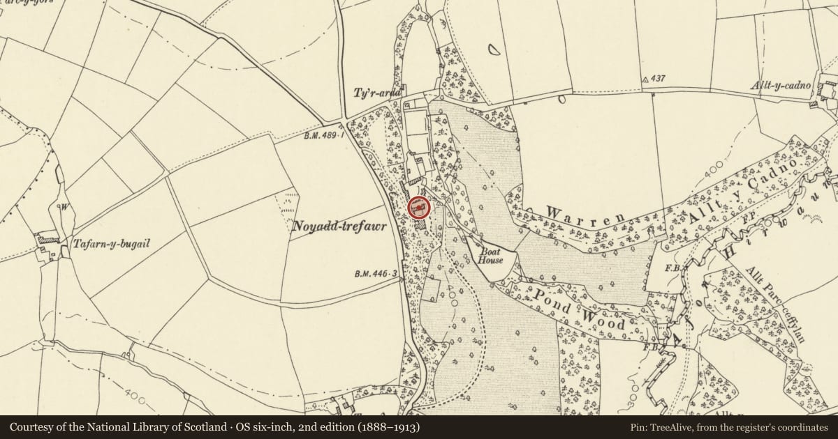
Slide toward Today to fade the historical sheet and see the modern map underneath.
David Rumsey Map Collection, Stanford LibrariesDavid Rumsey Map Collection, Stanford LibrariesDavid Rumsey Map Collection, Stanford LibrariesDavid Rumsey Map Collection, Stanford LibrariesDavid Rumsey Map Collection, Stanford Libraries
5 historical maps cover this location, the earliest the 1608 map "(13) Cambriae Typus." (David Rumsey Map Collection, Stanford Libraries).
Historical maps covering this location
- 1608 · (13) Cambriae Typus. (David Rumsey Map Collection, Stanford Libraries)
- 1830 · V.3:11-15:XV. Britisches Reich. A. Kon: England. b. Frstenthum Wales: Shire: 37-40 (David Rumsey Map Collection, Stanford Libraries)
- 1899 · 194 Llangranog (Hills) (David Rumsey Map Collection, Stanford Libraries)
- 1901 · Sheet 14. (David Rumsey Map Collection, Stanford Libraries)
- 1919 · Sheet 78. Lampeter. (David Rumsey Map Collection, Stanford Libraries)
Cadw's description
Location
Situated on N side of first courtyard, and forming S side of second courtyard.
History
Early C19 outbuilding, possibly earlier in origin, said to have been farm-house, with groom's house at upper end. Marked on 1841 Tithe Map.
Exterior
Rubble stone, colourwashed to S, with slate roof, and two ridge stacks with slate tabling. One and a half storeys. S front has centre plank door in gabled stone porch, flat head to entry under plastered gable. Square window each side, paired sashes to left, 12-pane fixed to right. Casement pair to far right. W end, built into bank, has casement pair. N side has casement pair each floor to left, upper one under eaves, then big stone lean-to with door in E end, triple casement S and two C20 stone dormers with casement pairs over. To right, stone dormer gable with casement pair breaking eaves, offset to left of ground floor casement pair with timber lintel. To right of right stack, a casement pair and door, both under eaves. E end loft casement pair.
Interior
Large timber-lintel fireplace in room to E of entry.
Reason for designation
Group value with Noyadd Trefawr.
Nearby in the register
- Stable Cottage at Neuadd TrefawrDomesticunder 1 mi
- Coach-House and Bellcote Range between second and third Courts at Noyadd TrefawrAgriculture and Subsistenceunder 1 mi
- Tenants Cottage, W side of S Court Noyadd TrefawrDomesticunder 1 mi
- Noyadd TrefawrDomesticunder 1 mi
Other entries of the same register within about three miles of this one, by straight line.