Cof Cymru: National Historic Assets of Wales · Wales
Horse and Jockey Public House
Offa, Wrexham, Wales
A Grade II listed building in Offa, Wrexham, designated on 30 May 1951.
The record
- Designation
- Listed building, Grade II
- Broad class
- Commercial
- Date of designation
- 30 May 1951
- Community
- Offa
- Unitary authority
- Wrexham
- Country
- Wales
- Coordinates
- 53.04610, -2.99495
- Cadw reference
- 1794
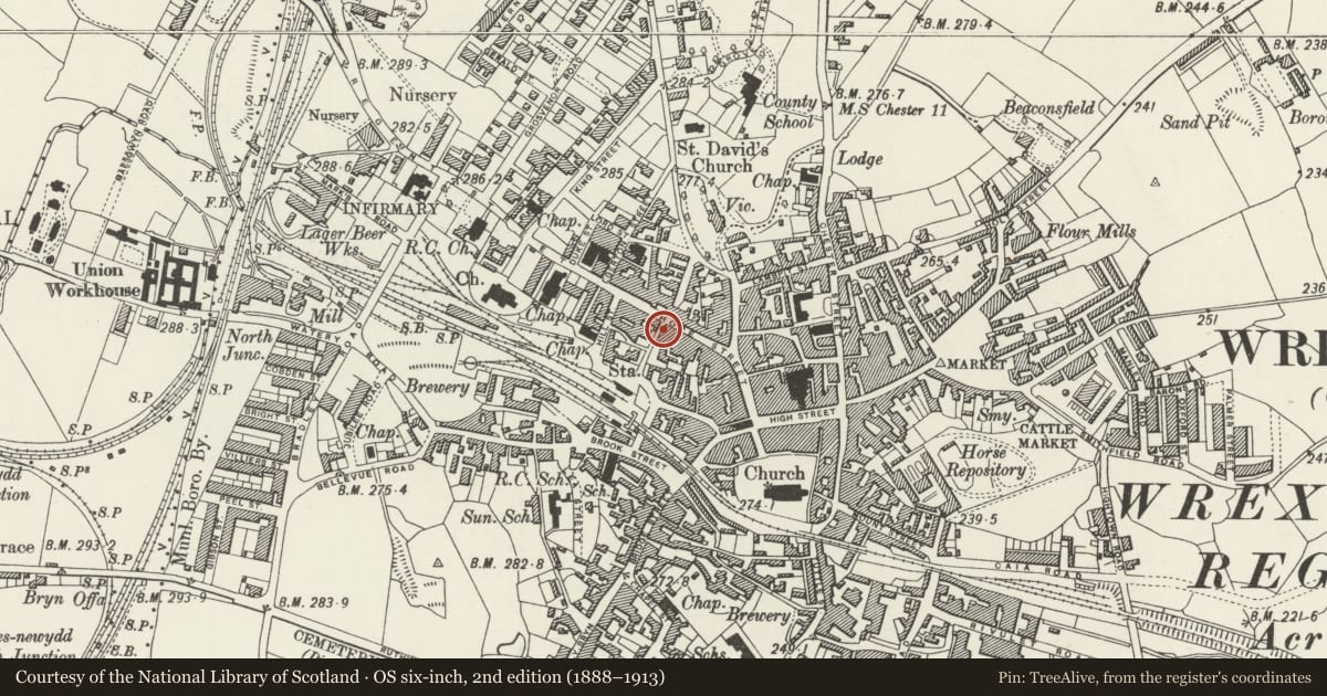
Slide toward Today to fade the historical sheet and see the modern map underneath.
David Rumsey Map Collection, Stanford LibrariesDavid Rumsey Map Collection, Stanford LibrariesDavid Rumsey Map Collection, Stanford LibrariesDavid Rumsey Map Collection, Stanford LibrariesDavid Rumsey Map Collection, Stanford Libraries
5 historical maps cover this location, the earliest the 1608 map "(13) Cambriae Typus." (David Rumsey Map Collection, Stanford Libraries).
Historical maps covering this location
- 1608 · (13) Cambriae Typus. (David Rumsey Map Collection, Stanford Libraries)
- 1883 · Watershed map England, Wales 3. (David Rumsey Map Collection, Stanford Libraries)
- 1898 · 121 Wrexham (Hills) (David Rumsey Map Collection, Stanford Libraries)
- 1898 · 121 Wrexham (Outline) (David Rumsey Map Collection, Stanford Libraries)
- 1901 · Sheet 9 and 10. (David Rumsey Map Collection, Stanford Libraries)
Cadw's description
Location
On the corner of Priory Street and Hope Street.
History
Public house, perhaps built as a dwelling, but in long-use as an inn. Possibly originally a C16 hall-house of 3 units, with an open 2-bay hall and storeyed end-bays, extended to the SW in the C17 and subdivided to form 3 cottages. Successively heavily remodelled in association with its use as a public house, leaving only fragmentary traces of its original form.
Exterior
Largely brick with roughcast render, but some surviving elements of timber-framing (not visible extenally), including timber studs in rear wall, and timber framed wall plate in part of SE wall. Thatched roof. Gable faces Hope Street, with doorway across angle with Priory Street. Renewed 3-light casement windows on each floor in gable. Long range to Priory Street has high gabled dormer window towards the centre, with massive stack breaking the roofline immediately to its left. 3-light casement window on each floor in this gable, and a smaller casement window to left of stack. 2 doorways in range to right of dormer gable, one with small window alogside, and 2 gabled dormers in the roof above. Stack on S gable wall.
Nearby in the register
- The Talbot Public HouseCommercialunder 1 mi
- 1-3 Queen StreetCommercialunder 1 mi
- The Cross Foxes Public HouseCommercialunder 1 mi
- The Old Swan Public HouseCommercialunder 1 mi
Other entries of the same register within about three miles of this one, by straight line.