Cof Cymru: National Historic Assets of Wales · Wales
Dog Yard Range
Marchwiel, Wrexham, Wales
A Grade II listed building in Erddig, Marchwiel, Wrexham, designated on 7 June 1963.
The record
- Designation
- Listed building, Grade II
- Broad class
- Domestic
- Date of designation
- 7 June 1963
- Locality
- Erddig
- Community
- Marchwiel
- Unitary authority
- Wrexham
- Country
- Wales
- Coordinates
- 53.02611, -3.00577
- Cadw reference
- 17854
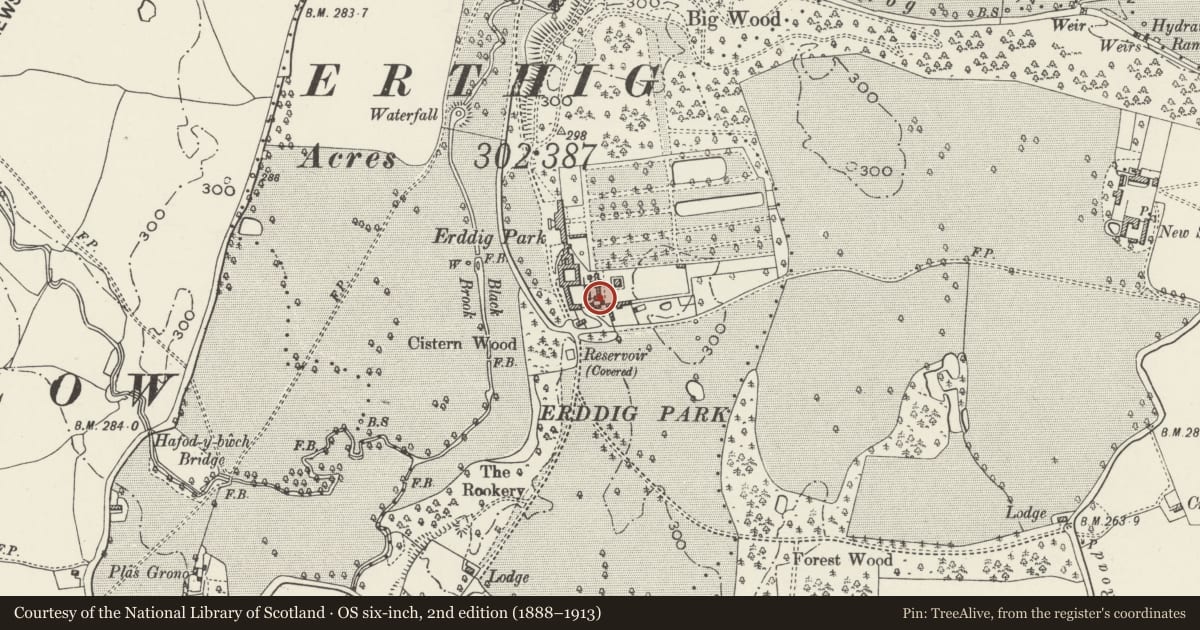
Slide toward Today to fade the historical sheet and see the modern map underneath.
David Rumsey Map Collection, Stanford LibrariesDavid Rumsey Map Collection, Stanford LibrariesDavid Rumsey Map Collection, Stanford LibrariesDavid Rumsey Map Collection, Stanford LibrariesLlyfrgell Genedlaethol Cymru – The National Library of Wales
5 historical maps cover this location, the earliest the 1795 map "To Sir Watkin Williams-Wynn Bart ... the map of the six counties of North Wales is most humbly inscribed by his obedient humble servant" (Llyfrgell Genedlaethol Cymru – The National Library of Wales).
Historical maps covering this location
- 1795 · To Sir Watkin Williams-Wynn Bart ... the map of the six counties of North Wales is most… (Llyfrgell Genedlaethol Cymru – The National Library of Wales)
- 1883 · Watershed map England, Wales 3. (David Rumsey Map Collection, Stanford Libraries)
- 1898 · 121 Wrexham (Hills) (David Rumsey Map Collection, Stanford Libraries)
- 1898 · 121 Wrexham (Outline) (David Rumsey Map Collection, Stanford Libraries)
- 1901 · Sheet 9 and 10. (David Rumsey Map Collection, Stanford Libraries)
Cadw's description
Location
Situated in a range of estate buildings S of Erddig on the S side of the limeyard.
History
Probably later C18 as part of Philip Yorke I's estate improvements of the 1770s. A plan of 1800 shows the complex and identifies a dog kitchen, flesh yard and kennels.
Exterior
Painted brick, slate roofs. L-shaped range of buildings closed on the W side by the wall of a waggon shed and on E side by a wall to form a yard. In the W wall is an opening leading to a room probably used to prepare food for the animals, on the N side a door and a window, an opening leading through to the limeyard, and to the right of this three doorways leading to former kennels. Running EW across the yard is a stone gutter which has several basins cut into it to form lapping pools.
Attached to the rear of the W side is a square section brick chimney which appears to relate to the former food preparation area.
Reason for designation
Listed as an unusual example of estate accommodation for dogs and for group value with other listed buildings at Erddig.
Nearby in the register
- SawmillIndustrialunder 1 mi
- Gardener's House including Bothies, walls and shed to WDomesticunder 1 mi
- Coachman's HouseDomesticunder 1 mi
- Former Haybarn to Outer YardDomesticunder 1 mi
Other entries of the same register within about three miles of this one, by straight line.